
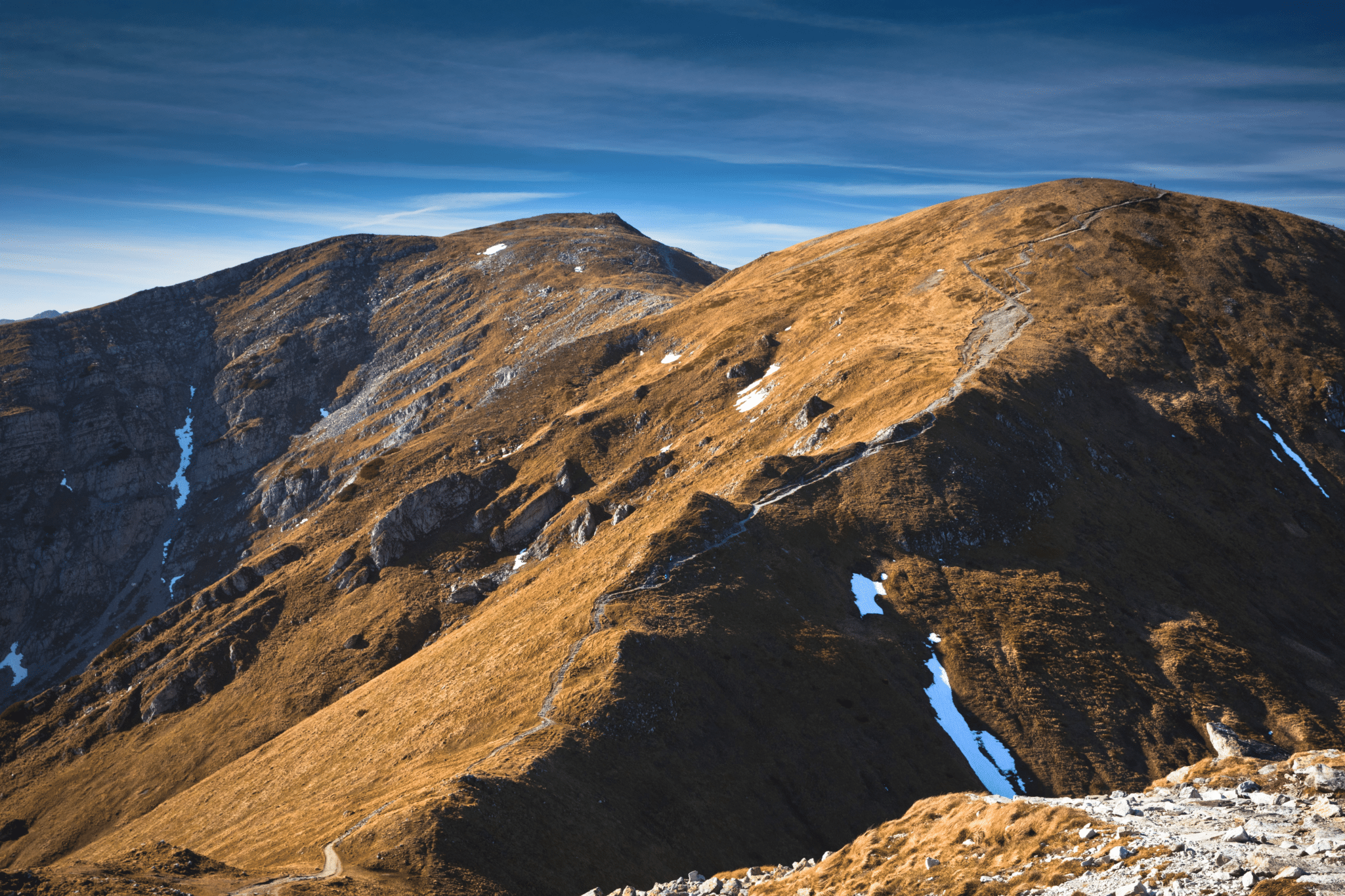
Czerowne Wierchy is a name given to a group of four peaks in Western Tatra: Kopa Kondracka (2005 masl), Małołączniak (2096 masl), Krzesanica (2122 masl) and Ciemniak (2096 masl). The mountains make ridge which is a very popular hiking destination from Zakopane. Hiking Czerwone Wierchy is an ultimate ridge walk experience in Tatra, one everyone should definitely try while in Polish mountains.
Hiking Czerwone Wierchy – iconic ridge walk in Western Tatra
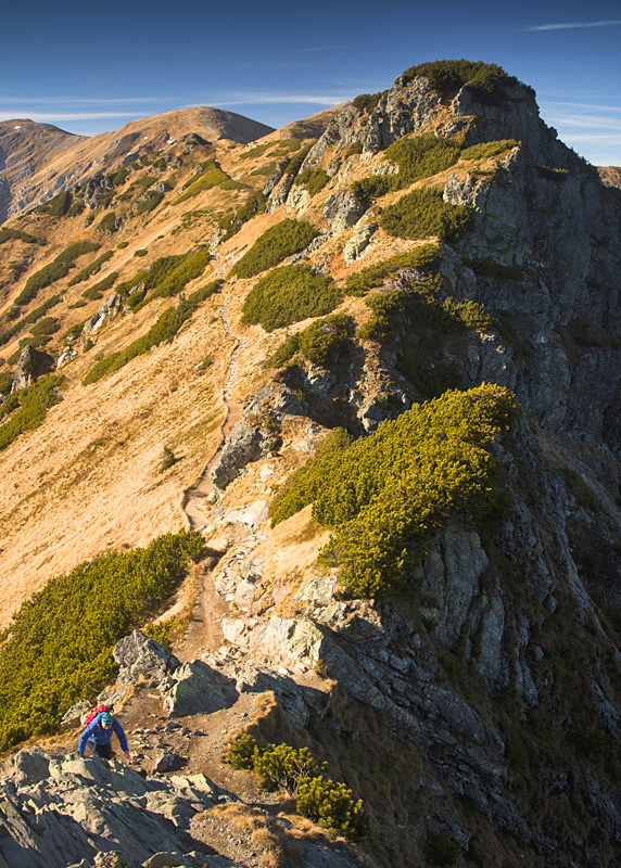
- Height: Kopa Kondracka (2005 masl), Małołączniak (2096 masl), Krzesanica (2122 masl), Ciemniak (2096 masl)
- Total time: 7 hours
- Total distance: 21 km
- Total Ascent: 1462 metres
- Total Descent: 1589 metres
- Parking: we recommend parking in Zakopane and taking public transport to Kuznice, where the hike starts
- Level of difficulty: 3/5 – long ridge walk
- Czerwone Wierchy weather: weather forecast for Kopa Kondracka
- Which map: Tatrzanski Park Narodowy (click to buy)
How to get to Kuznice from Zakopane
The easiest way to get to Kuznice is taking a mini-bus from Zakopane. Cost of such journey is 3 PLN (autumn 2018). Depending on the season, one should apply different strategy of catching a mini-bus. Don’t get me wrong, they do have an official schedule and run regularly, but in the summer they fill up with tourists and hikers already on their first stop, so catching one further along the way might be a challenge. This is not a problem in lower season, but in the summer we recommend catching mini-buses on their early stops, for example at Zakopane train station, Dolne Krupowki or Gorne Krupowki.
We definitely do not recommend driving to Kuznice – this actually is impossible. Final 3 km of road to cable car station are classified as a private road, only public transport is allowed. One would have to leave their car on sparse and expensive public car parks and still take a mini-bus or walk to the trailhead.

Hiking from Kuznice to the foot of Czerwone Wierchy ridge
Kuznice is a busy place as several trails start there and for a first time visitor it might be a bit confusing. So how to ensure that you hit the right path? It’s easy! Once you get of mini-bus or taxi, face the cable car station. Walk about 40 metres to the left , until you see signposts. Take BLUE trail to Polana Kondratowa.
The trail begins as a wide, cobblestone track up the hill. After 15 minutes you’ll pass a Catholic Sanctuary of Brother Albert, continue ahead. Soon after the sanctuary you’ll be asked to pay admission fee to Tatra National Park (5 PLN per person, autumn 2018). After another 5 minutes, BLUE trail forks: one leg diverts to Polana Kalatowki, the other leg (lower trail, on the left) continues directly to Polana Kondratowa (this point is marked, do not worry – you won’t miss it; and if you do, it’s ok, you’ll still arrive to Polana Kondratowa, just a bit longer way). From the fork it’s about 1 hour walk to the hut on Polana Kondratowa. The path narrows down, climbs a bit but still continues through the forest while opening up from time to time – an easy and enjoyable walk.
A word of advice – skip Polana Kalatowki and walk directly to Schronisko na Hali Kondratowej (Hala Kondratowa mountain hut) located on Polana Kondratowa, as this is much nicer place for a break.

Hiking Czewrone Wierchy ridge
There are two ways to reach Czerwone Wierchy ridge from Polana Kondratowa.
First, direct way follows GREEN trail to Przelecz pod Kopa Kondracka (mountain pass at Kopa Kondracka). Alternatively, you can take BLUE trail to Kondracka Przelecz (near Giewont) and then follow YELLOW trail to Kopa Kondracka, however this option is longer.
In this post, we focused on GREEN trail – direct ascent to the ridge, meeting it at Przelecz pod Kopa Kondracka. This route is a steady climb with beautiful views back to Polana Kondratowa. It takes about 85 minutes to reach the pass, but the time goes quickly.
Having already climbed the the mountain pass, it’s only a short walk (20 minutes) to the summit of Kopa Kondracka – first of four peaks of Czerwone Wierchy, and the first peak of the day. Top of Kopa Kondracka is famous for fantastic 360 degrees panoramic view over Polish and Slovak mountains.

Last time we visited Czerwone Wierchy (in 2018), it was very foggy and we could hardly see further than few meters ahead! However, this didn’t stop us from hiking – trail running along the ridge is very well defined, therefore it’s easy to follow even in low visibility. Of course, it’s a much greater experience hiking in sunshine and enjoying the views, but one thing to keep in mind while walking along high mountain ridges is: often clouds just come and go! Meaning: even if you start the hike in low clouds, you’re still likely to see blue sky at one point. Also, remember that the ridge makes a Polish – Slovak border; the trail actually subtly crosses the border – sometimes path is on Polish, sometimes on Slovak side.
During our visit to Tatra back in 2010 we had beautiful weather and the mountains were covered in snow, despite it being early September. That was very surprising as we prepared for summer holidays, but having arrived to Zakopane, we found the mountains in winter attire.

Malolaczniak is the next summit along Czerwone Wierchy ridge. It’s rather prominent, albeit rounded mountain, hence easy to climb!
Past Malolaczniak is Krzesanica. Although it’s the highest summit of the ridge, it’s not marked. Luckily, there are many cairns (pile of stones) around the peak, so it’s easy to identify.
Ciemniak is only a stone’s throw from Krzesanica! It’s a gently rounded bump, rather than a peak, but somehow we really like it; in fact it’s our favourite summit of Czerwone Wierchy. Located at the very end of the ridge and being over 2000 metres high, Ciemniak is a great viewpoint to Dolina Koscieliska and Dolina Tomanowa.
Descent from Ciemniak to Dolina Koscieliska
Unfortunately, descend from Ciemniak to low level valleys is long and tiring, but that’s Ciemniak’s only downside.
There are two descent paths to choose from, both reach Dolina Koscieliska within approximately 2.5 hours.
The shortest option is taking RED trail, which follows Ciemniak’s northern slopes and descends directly to Dolina Koscieliska, somewhere mid-way. Descent distance is approximately 5.3 km, height lost is 950 metres; there are steep sections along the way.
However, we recommend descending along GREEN trail to Chuda Przelaczka, and following it all the way down to mountain hut at Hala Ornak, at the very end of Dolina Koscieliska.

Although GREEN trail makes a longer descent route to Dolina Koscieliska, we liked it much more than direct one. Along green trail you’ll visit Dolina Tomanowa – a high valley with amazing viewpoints (walking time 3.25 hours, distance 11 km, height lost 1113 metres). Also, it’s a gentler, quieter and more picturesque way – you’ll definitely like it!

One more advantage of GREEN trail is passing mountain hut at Hala Ornak, with its famous ‘szarlotka’ – Tatran delicacy (apple pie)! You’ll be pleased to know that szarlotka sold in this very mountain hut is the best in Tatra! We strongly recommend trying the ‘deluxe’ option – with fresh fruit and cream, you’ll love it!
Whichever route you choose, you’ll finish your hike in Dolina Koscieliska – our favourite valley in Tatra. We always find it a nice stroll; along the valley are numerous meadows, craggy hills, ever-green spruce woodland, caves. It’s a perfect, relaxing end after intense walk along Czerwone Wierchy ridge (1.25 hours walk from Hala Ornak to bus stop in Kiry).
At the end of Dolina Koscieliska is a Kiry village – there you’ll easily find public transport to Zakopane.
Czerwone Wierchy (iconic ridge walk in Western Tatra) hiking map

What we liked about hiking Czerwone Wierchy ridge
Czerwone Wierchy is a classic ridge walk in Polish Tatra mountains, with spectacular views to both Polish and Slovak mountains. It’s also our favourite ridge hike! The best season for hiking the ridge is autumn when grass covering the hills turns red (hence the name Czerwone Wierchy, which translates to Red Peaks) and rounded summits look spectacular. The ridge doesn’t disappoint in winter either – in fact it would make a perfect introduction to winter hiking in Tatra. To be honest, we hiked Czerwone Wierchy over a dozen times over the years, and it’s still one route that we always re-visit whenever we pop in to Zakopane!

LOOKING FOR OTHER AMAZING HIKES IN TATRA MOUNTAINS? CHECK OUT THESE TRAILS!
If you’re looking for other hiking ideas in Polish Tatra mountains, from Zakopane, check out these amazing walks! All include detailed route descriptions and hiking maps:
ZAWRAT – hike from Zakopane to Zawrat mountain pass and Dolina Pieciu Stawow. It’s a challenging trail and makes for a great introduction to scrambling in Tatra (security chains)
GIEWONT AND KASPROWY WIERCH – amazing day hike to two most iconic peaks in Western Tatra
FROM MORSKIE OKO TO DOLINA 5 STAWOW VIA SZPIGLASOWA PRZELECZ – a long and challenging hike thru some of most spectacular scenery in High Tatra range
Finding accommodation in Zakopane
You will be pleased to know that we thought about everything to make your visit in Zakopane nice and easy, hence it won’t come as a surprise that we even hand picked some fine accommodation options for you!
Head to Where to stay in Zakopane, our top 10 picks for ready, preselected accommodation for you. Booking your stay in Zakopane has never been easier!
*Level of difficulty explained: 1– easy walk, mostly flat 2-easy hillwalk, good path 3-moderate, possible some steep sections 4-long hillwalk, possibly some scrambling involved, possibly pathless 5-difficult, possibly pathless, long, requires technical skills
