
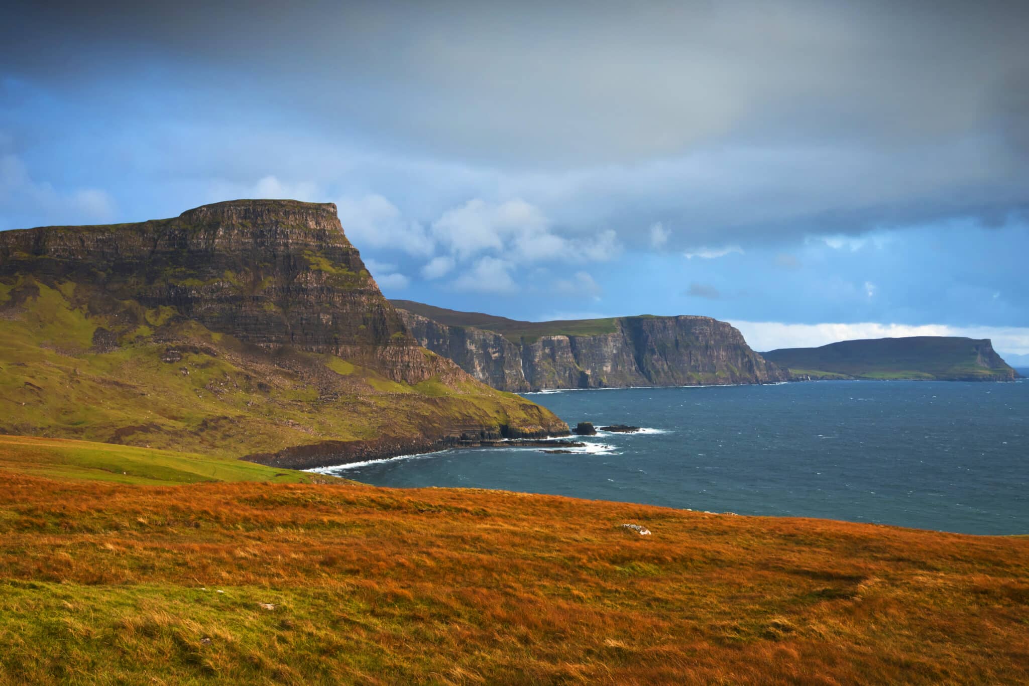
If you’re craving landscapes that look as if they belong in a myth, with mist-draped mountains and dramatic coastline, the Isle of Skye will not disappoint. Just off Scotland’s west coast, Skye is often called the crown jewel of the Hebrides, and it more than earns the title. Here, towering sea cliffs meet glistening lochs, waterfalls tumble into the Atlantic, ancient castles stand guard over centuries of history, overlooked by beautiful but ill-fated mountains. Add in villages alive with Gaelic heritage and a thriving food scene, and you have an island that’s as rich in culture as it is in natural beauty.
Too often, though, visitors dash through Skye in a day or two, ticking off the highlights from the comfort of a car. While the island is undeniably breathtaking on a whistle-stop tour, Skye really only reveals its character when you slow down (and we know that from our own experience). Spending five days here lets you do more than glimpse the famous sights – you’ll have time to linger, to explore remote headlands or even hike to the legendary Cuillin hills, to watch the light shift across the Quiraing, and to wander into places that never make it onto postcards.
This itinerary is designed to balance Skye’s must-see icons: the Old Man of Storr, the Fairy Pools, Neist Point with quieter corners where you can truly soak in the island’s magic. It’s an invitation to go beyond the quick drive-around and experience Skye in a way that feels both adventurous and deeply rewarding.
Ready to explore?
Read our tips before you head to Skye.
Check our recommended accomodation on Skye.
Find and compare the cheapest rental car rates, if you are planning to drive from any city in Scotland to Isle of Skye .

Isle of Skye 5 days itinerary
Day 1: Elgol, Boat trip to Loch Coruisk, a hike to Camasunary Bay
Day 2: Sligachan Bridge, Fairy Pools, Talisker Bay and Distillery, a hike to Ben Tianavaig
Day 3: Isle Oronsay, Neist Point, Fairy Glen
Day 4: Rubha Huinish, Quiraing, Staffin beach dino prints hunt
Day 5: Old Man of Storr, Portree
How to get to Isle of Skye
There are no commercial airports on Isle of Skye, and the nearest international airport is located in Inverness.
The easiest way to get to Skye is driving, and most visitors do arrive to the island by car.
From any direction, the drive to Skye takes you through some of the most beautiful scenery in Scotland.
FROM EDINBURGH The quickest route from Edinburgh is via the A9 and then through Spean Bridge (around 200 miles / 250 km, journey time 4.5–5.5 hours). Alternatively, you can drive through the stunning Glen Coe via the A82, a slightly busier but far more scenic route that also gives you the chance to spend a day exploring Glen Coe’s dramatic landscapes.
FROM GLASGOW When driving from Glasgow, take the A82 along Loch Lomond and Glen Coe. (circa 180miles/ 220km, journey time 4.5 hours)
FROM INVERNESS The distance from Inverness to Skye is roughly 115miles/185km with journey time between 2 -2.5 hours. The route crosses some of Scotland’s wildest areas as it follows road A890 to Loch Carron.
Conveniently Skye is connected with Scottish mainland by a bridge (Kyle of Lochalsh to Kyleakin), so no ferry crossings are necessary. But, if you’d like the experience of coming to Isle of Skye by ferry, you can do so by picking the connection between Mallaig and Armadale, or Glenelg to Kylerhea. Skye is also well connected to the Outer Hebrides (ferry from Uig to Tarbert and Lochmaddy).
For purpose of this article, we assumed that you’ll be arriving to Isle of Skye from the east; either by the bridge, or by ferry from Mallaig – as most visitors do.

Planning a trip to Isle of Skye?
Get our ultimate e-guide:
- 370 pages
- Google map with QR codes
- detailed description of 26 hikes with maps
- beautiful photographs to inspire your trip
Without further ado, let’s have a look at 5 day Isle of Skye itinerary for Outdoor Lovers
Day 1
CAMASUNARY BAY
Lets start our excursion with a hike to remote beach. Its sense of isolation, combined with views across Loch Scavaig to the mountains, makes Camasunary a favourite for hikers, photographers, and anyone seeking Skye’s wild beauty and solitude.
There are many approaches to Camasunary Bay. We have chosen this as the trail head is conveniently located on the way to Elgol and there are some stunning views from Am Mam pass (the highest point of the hike).
Although straight forward, the walk will raise your heart rate as it climbs to a small mountain pass before descending to the grand Camasunary Bay.
The path begins shortly before Elgol, weaving gently across moorland with the Cuillin mountains looming like a dark, dramatic backdrop. There’s an immediate sense of stepping into a wilder, quieter world, where the only sounds are the wind in the heather, occasional cry of a seabird and a loud ‘baaa’ from lambs grazing nearby.
Rounding a bend at the mountain pass, the landscape suddenly opens and Camasunary Bay reveals itself: a sweeping curve of pale sand framed by rugged headlands, the sea shifting through shades of turquoise and steel-grey depending on the mood of the sky. It’s a place that manages to feel both remote and deeply welcoming.
Looking down you will spot 3 buildings in the bay, a grey stone cottage, a white house and far in the distance an old bothy – now in disrepair.
Many walkers pause at the small stone bothy near the shore, a haven for those staying overnight or simply seeking shelter with a flask of tea. Whether you linger or head back the same way, the memory of that secluded bay – its raw beauty, its quiet calm travels with you long after you leave.
We recommend exploring the spacious meadow bordering the bay, walking to the far side of the beach in search of seals basking in the sun on nearby rocks.

Moody morning at Camasunary Bay
ELGOL
This picturesque village guarantees breath-taking views to Cuillin mountains. Explore the foreshore, with ‘honeycomb’ rock and small sandy beach -but these can be left for the evening. Firstly walk to the hut at the harbour slipway and arrange a boat trip to Loch Coruisk.

View to Cuillin hills from Elgol
LOCH CORUISK BOAT TRIP FROM ELGOL
Two operators offer boat trips from Elgol, whether wildlife spotting on a rib boat or sailing to Loch Coruisk on a converted fishing boat. Both options are attractive, and we believe nothing beats visiting Loch Coruisk- a gem in the middle of Black Cuillins- probably the most beautifully located loch in Scotland.
Note that visiting Loch Coruisk requires a 10mins walk from boat landing, but it’s an easy walk over a good path. Landing pier for Loch Coruisk trips is at the sheltered cove of sea loch Loch Scavaig (near seal colony), Loch Coruisk is a freshwater loch connected to the sea by Scavaig river. A short walk from landing will take you in the very heart of Skye’s legendary mountains – Black Cuillins- and all that without walking a single step uphill 😊
Explore the shores of Loch Coruisk, maybe even cross Scavaig river over stepping stones for a new perspective and extended views.

Loch Scavaig (left) and Loch Coruisk (right) in the heart of Cuillin mountains
ACCOMMODATION for night 1: Elgol or Broadford
Day 2
Second day of your Skye adventure will take you to some of island’s most iconic landmarks and a fantastic viewpoint reachable along a short, straightforward hike.
Leave Elgol/Broadford and follow main road A87 as far as Sligachan.
SLIGACHAN BRIDGE
Probably the most recognisable landmark of Skye is the old stone bridge over river Sligachan. It’s really easy to find. You can park for free at the hotel or at the dedicated car park. Either way, it’s only about 50yrds to reach the iconic bridge, famously posing with the backdrop of high jagged ridge of Black Cuillins. Look out for a recently erected monument dedicated to Skye guides and pioneers, John Mackenzie and Norman Collie.
Aim to visit the bridge as early in the morning as possible, it presents especially beautiful at first light, with sunrise hitting the mountains.

Sligachan bridge posing on a backdrop of Marsco and Black Cuillin mountains
FAIRY POOLS
After a visit to Sligachan, we suggest exploring Fairy Pools – only a short drive away.
The pools, known to have been a tourist trap, recently got access road upgraded, and a new large car park (pay and display).
The busiest time at the Fairy Pools is mid-day and early afternoon, but if you started the day early to enjoy warm light at Sligachan, you will have arrived to Fairy Pools before the main tourist wave.
Fairy Pools are a series of cascades and small basins along river Allt Coir a’Mhadaigh, with a backdrop of rocky Cuillin Ridge. To see most, if not all cascades, hike along the river (newly constructed path, up to 1.5km each way).

Fairy Pools view
TALISKER BAY & DISTILLERY
Next stop on the Skye road trip is Talisker Distillery (or/and Talisker Bay) Note that the distillery is located in Carbost, not Talisker village.
Talisker Bay is one of those corners of Skye that feels like a secret, even though it lies only a short walk from the road’s end near Carbost. The approach itself is part of the charm: a gentle stroll down a farm track, with rolling hills around you and the distant murmur of waves teasing what lies ahead. After fifteen minutes, the landscape opens and you find yourself looking onto a broad, pebbled bay framed by high cliffs that rise like sentinels on either side (look out for a waterfall to the right)
The beach is strikingly different from Skye’s more famous sandy stretches. Here, smooth black stones dominate, gradually giving way to a strip of dark volcanic sand at low tide. When the light catches it just right, the sand shimmers with silvery reflections, creating a setting that feels almost otherworldly. To the north, a tall sea stack stands proud against the Atlantic swell, while waterfalls sometimes tumble down the cliffs after rain, adding to the drama.
What makes Talisker Bay special is its moodiness—this isn’t a place of bright postcard colours but of atmosphere. Come at sunset and you might see the cliffs bathed in gold, the waves rolling in with rhythmic grace. It’s peaceful, elemental, and quietly unforgettable.

Talisker Bay
BEN TIANAVAIG
A splendid finish to a day filled with iconic views! Ben Tianavaig is a clifftop over a Sound of Raasay, just before Portree.
In exchange for a short, but steep hike you’re guaranteed breath-taking overview of Loch Portree, and a glimpse of a distant Trotternish Ridge, with distinctive cliffs of Storr. A hike to the top of Ben Tianavaig takes 3-4 hours (6km there and back).
Tianavaig is one of lesser known hiking routes on Skye and enjoyed primarily by local dogwalkers, so expect a serene walk with spectacular scenery.
ACCOMMODATION night 2: we suggest Portree or Struan/Ose.

Trotternish Ridge and cliffs of Storr seen from Ben Tianavaig
Day 3
Day 3 of our Isle of Skye itinerary explores the western side of the island, and will have you discover some famous locations, but also a little known gem of a tidal island of Oronsay.
ISLE ORONSAY
This dolphin-shaped island is one of the best kept secrets of Skye and very few explore it. Located off the shores of Ullinish village, a very short drive from Struan and Ose, Oronsay invites for a short coastal walk with stunning views. Getting to/from the island is possible within a window of 1.5 hours each side of the lowest tide, when you will be able to cross to Oronsay along a pebble beach. Once on the island you can pick between a couple of paths to explore the land, stick to the one that feels best underfoot. The island is small and easily explored – don’t skip a short climb to a viewpoint at the far end to see MacLeod’s Maidens sea stacks in the distance, and sailboats gracefully gliding around the islands of Loch Bracadale.
Retrace your footsteps to Ullinish and continue to one of the most iconic landmarks of Isle of Skye – its westernmost point – Neist Point.

Bird-eye view of Isle Oronsay on Loch Bracadale
NEIST POINT
A pleasant 40mins drive will take you thru serene rolling hills of Waterstein region, to the famous Neist Point- the westernmost point of Skye.
A narrow headland crowned with a lighthouse attracts thousands of visitors as it reaches far into the sea. While at Neist Point you can pick between 3 options for your visit. One- admiring the headland and lighthouse from the cliffs; two- exploring the cliffs in search of a perfect viewpoint (note that the clifftop path is usually quite wet). And finally option three (which we recommend) walk down the cliff to the headland and the lighthouse via concrete steps and walkway, take time to explore the rocky shores of Neist Point and ensure to climb to the viewpoint at An-t-Aigeach.
Neist Point is incredibly popular for evening photography when the cliffs and lighthouse are illuminated by setting sun. Dozens of photographers hope for a perfectly illuminated Neist Point every day, but capturing the sunset here is not an easy task.
Apart from the lighthouse and Neist Point headland, another local landmark deserves your attention- an impressive high clifftop of Waterstein Head, to the west from Neist Point, just across Moonen Bay. In our opinion it’s just as photogenic as Neist Point.

Cliffs of Waterstein Head and classic view of Neist Point (insert)
FAIRY GLEN
The next point of interest is a greatly loved Fairy Glen, shortly before Uig, a pleasant 1 hour drive along the main road. Back on Trotternish peninsula, the road will be busier with traffic but also so much easier being back to standard 2 lanes.
Fairy Glen will appeal to all kinds of visitors, is suitable for all levels of fitness, and children. A flat paved track that runs long the glen makes it really easy to visit famous landmarks like Castle Ewen rock (Fearie Castle). You can climb to the top of castle rock, or just admire it from a viewpoint along the paved track near the pond.
A visit to Fairy Glen would take approximately 1.5-2 hours, at leisurely pace.
NOTE: if you didn’t manage to visit Isle Oronsay due to inconvenient tide times, you may want to add a hike to Rubha Huinish and a visit to Duntulm Castle at the end of day 3. It’s only a 20mins drive to Rubha’s car park from Uig.
ACCOMMODATION night 3: we recommend staying local in Uig as the next day explores more of stunning Trotternish Peninsula.

Fairy Glen: Castle Even rock
Day 4
Day 4 offers a variety of adventures; two fine hikes in Skye’s finest peninsula- Trotternish as well dinosaur print spotting and a visit to a ruined Duntulm Castle.
DUNTULM CASTLE
We suggest starting the day easily, by a stopover at Duntulm Castle. Once a fortress at the edge of Trotternish, it fell in disrepair and its stone was eventually recycled by local crofters. Get to the ruins along a path (a very short walk) and enjoy the view over Tulm Bay with a small beach. Looking to the north you can track the low grassy meadows – you will cross these on the way to Rubha Huinish, the next point of interest. Look out for remains of a village between meadows and the beach – a small community thrived at the furthest corner of Isle of Skye before being removed by mighty landowners looking to expand their pastures.
RUBHA HUINISH
Trailhead to the northernmost point of Isle of Skye lies less than a kilometre away from Duntulm Castle. Park at Shulista (dedicated car park for Rubha Huinish) and pass the gate. Immediately past the gate you’ll find a grassy path that runs alongside a fence – follow it. Soon you’ll be traversing a heathery plain with a low hills on both sides.
The path will fork to the right, giving you a chance to visit a ‘Lookout Bothy’, and old bothy at the cliff edge, overlooking the Minch – a stretch of water between Skye and Isle of Harris. If lucky, you may see dolphins or even a whale!
To explore Rubha Huinish, return to the main path on a heathery plain and walk north until reaching a metal gate at the cliff edge.
You need sturdy boots to descent to moon-shaped headland of Rubha Huinish, it’s a straight forward route of medium difficulty. Keep in mind that rocks may be slippery when wet, and use handholds whenever possible.
Although initially a prospect of descending to the bottom of a cliff may seem intimidating, it gets easier with every step – and the reward of exploration of such a remote corner of Skye is most definitely worth the effort. While the western side of Rubha features a gentle coastline, the eastern side if home to low cliffs and hidden sea stacks.
Retrace your steps up the cliff path to return to high ground and further to the car park.
The whole Rubha Hunish hike takes about 4 hours

Rubha Huinish seen from Lookout Bothy
QUIRAING
After a visit to Rubha Huinish you will be well warmed up for a hike at Quiraing. This site of ancient landslide features unique rock formations, columns, and pinnacles. Pick one of 3 route variants and enjoy this ancient landscape*.
Start from the dedicated car park, cross the road to find a well-trodden path towards Quiraing. Immediately you’ll be greeted by spectacular views towards the grey cliffs, framed by a yellowish grass- you can expect to see photographers awaiting perfect light, with tripod mounted cameras. Remember to look back, the rugged grassy ridge beyond the car park is the iconic Trotternish Ridge; it’s highest spot – cliffs of Storr, is home to another famous landslide site and its legendary stack Old Man of Storr.
Quiraing features some unique rock formations, you will see some or all of them, depending on the chosen route. Don’t miss The Prison, The Table and The Needle nor Fingal’s Pinnacles.
Interstingly, Quiraing is an active site, still nowadays the land continues to move towards the sea at hardly measurable pace, but this landscape will change for future generations.
*find out how to enjoy a day at Quiraing (and more!), and recommended hiking routes. We reveal all in detail in our e-book.

The Prison- one of the unique rock formations in Quiraing
DINOSAUR FOOTPRINT HUNT AT STAFFIN BEACH
We recommend finishing the day off with a beach walk with a twist! Beach at Staffin does not feature spectacular golden sands (but white and grey) but attracts curious visitors with a promise of dinosaur footprint spotting.
PRO TIP:
There are at least 3 prints to be found on the fossilised mud flats (flat rock nearer the shore) on the gently rippled bed near the corner of the beach. By no means, finding them is an easy tasks even when you know exactly where to look!
ACCOMMODATION: For your final night in Skye we recommend Flodigarry, Staffin, or Portree

Look out for footprints like this one, while on Staffin beach
Day 5
Your final day in Skye includes exploration of the Storr and a climb to the Old Man, and a farewell visit to Skye’s capital -Portree, before leaving the island altogether.
You can pick the order of the day depending on previous night’s accommodation location; if you stayed in Portree, start by exploring the town before moving on to the Storr.
PORTREE
The largest settlement in Skye, island’s capital. The town wows with its harbour and colourful fisherman’s cottages, picturesque Loch Portree surrounded by high rugged shores. A keen walker will discover some of the local’s short hikes – to Ben Chracaig, Scorrybreac viewpoint or Apothecary Tower. The town itself is very easy to explore on foot, most of cafes and gift shops can be found in the compact rectangular area between The Green and Wentworth Street.

Portree harbour
CLIFFS OF STORR AND THE OLD MAN OF STORR
Similarily to Quiraing, the majestic site you visited on day 4, The Storr also is a landslide site.
The whole of Trotternish Ridge, including the Storr, was formed by massive landslips and the process continues to be active, with the land moving at a slow rate each year. While the Storr formation itself may be stable, other areas within the Trotternish Ridge remain active, and the site is characterized by continuing processes of detachment and movement.
While Storr and Quiraing produced some spectacular formations, other areas generally feature less interesting sites, unless you’re a keen geologist.
Old Man of Storr is usually invisible from the road level as it blends with the grey rock of cliff face. To admire the fantastic stack, set off for a short hike along a well maintained track. While a walk to the Old Man of Storr may be a short hike, the route rises considerably and will definitely rise your heartrate.
Due to erosion you may not climb to the stack itself, but admire it from the foot. Old Man’s ever growing popularity resulted in extremely high erosion at the base and fears that the stack may fall in the future.
While exploring the area below the Old Man, pay attention to The Needle Rock– a tall pinnacle, and note two viewpoints only a short walk away. First located opposite the Needle Rock and another slightly higher, at the northern arm of cliffs of Storr.

Old Man of Storr and The Needle at sunrise
With the visit to Skye’s capital and the most iconic landmark – The Old man of Storr you completed the 5 day Isle of Skye itinerary.
We hope that the weather allowed you to enjoy all suggested locations and activities!
Get in touch with us to share your experience of Isle of Skye!


