
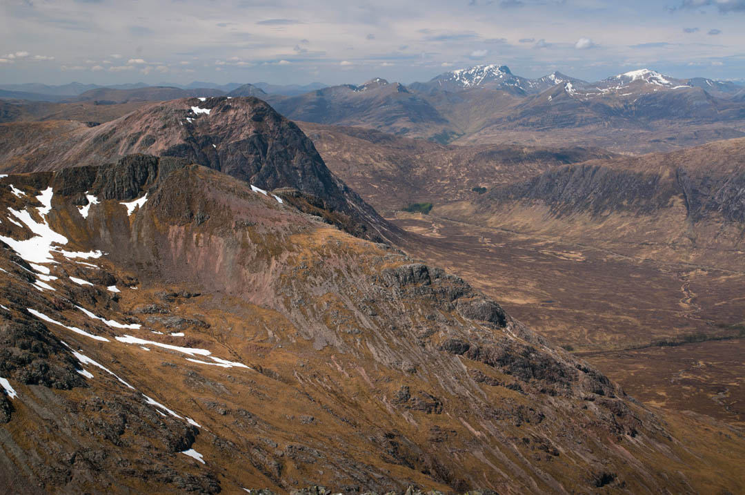
Glen Coe (often referred to as ‘Glencoe’) is probably the most beautiful Scottish glen, definitely one of the most dramatic! U-shaped, formed by an ice age glacier, it follows river Coe (hence the name). Several of majestic mountains raise on both its sides.
Reading our articles you have probably gathered that our motto says ‘no road trip gives you the same feel of the place as a hike does!’ Indeed, the massive tourist traffic thru Glencoe proves that the road trip is still pretty awesome, but we can’t stress enough how important it is to hit the trail to appreciate the beauty of Glen Coe.
Yes, the majestic mountains look amazing from the roadside, but try a couple of hikes in the area and you’ll be awed forever (and long to come back). To encourage you to explore this stunning area on foot we have prepared the list of the best Glencoe hikes, we’re also giving you detailed, first-hand information and account of many of them, as per our own walking experience!
You can rely on our route descriptions and directions, we walked them hence do provide the most reliable information there is! Several of Glencoe trails we have completed in different seasons and conditions, we also mapped a couple of ‘bespoke’ routes.
Don’t delay, plan your hiking trip to Glencoe, climb these majestic mountains and enjoy Scottish landscape and nature at its best!
14 best Glencoe walks, Scotland
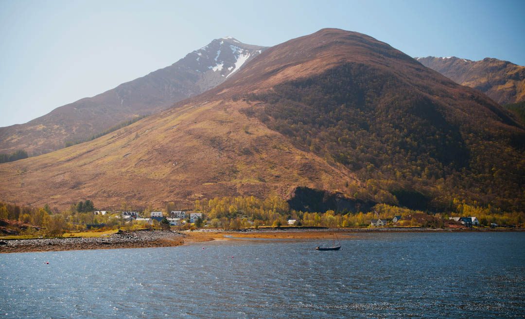
1.Ballachulish and Loch Leven walk
2.Lost Valley
3.Pap of Glencoe
4.Bidean Nam Bian
5.Buachaille Etive Mor
6.Buachaille Etive Beag
7.Beinn a’Breithir
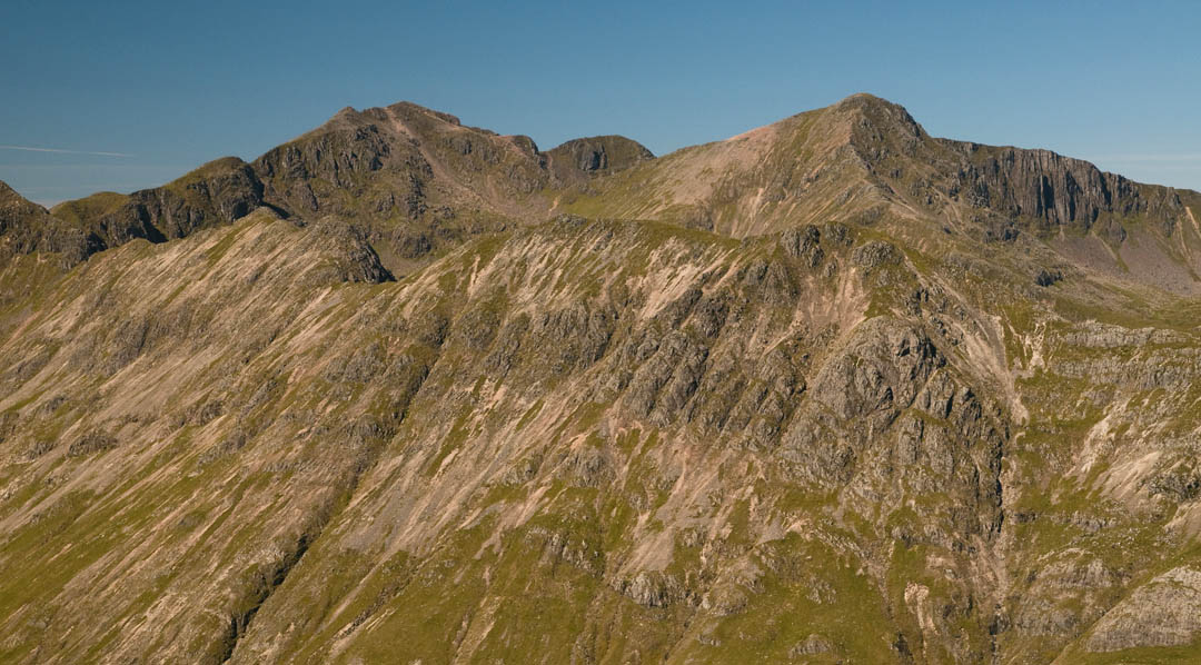
8.Aonach Eagach
9.Creise and Meall a’Bhuiridh
10.Beinn a’Chrulaiste
11.Stob Coire Nan Lochan
12.An Torr and Signal Rock
13.Glencoe Lochan walk
14.Altnafeadh to Kinlochleven via Devil’s Staircase
")
A comprehensive guide to best hiking trails in Glencoe
- detailed trail descriptions with hiking maps
- Google Maps coordinates for parking
- Information about public transport
- breath-taking photographs
1.Ballachulish and Loch Leven walk
Length: 2km Time: 1-2 hours Level of difficulty: easy, Circular walk
This short, easy hike gives a perfect opportunity to explore Ballachulish village at the shores of Loch Leven, overlooked by majestic mountains of Glencoe. Conveniently, the walk starts from Ballachulish visitor centre (large car park, coffee shop, toilets) which is really easy to find.
Initially you’ll explore the historic village of Ballachulish, only to progress slowly to the shores of Loch Leven. Ballachulish has been known for it slate quarries, and you can easily spot reminders of the past around the village. When you make your way to Loch Leven, via underpass under road A82, look out for old slate huts at the shores, due to their natural colour they’re easy to miss. Take your time to explore the small peninsulas of Loch Leven, take in the view to nearby Pap of Glencoe, a cone-shaped summit overlooking the loch. On a warm sunny day you’ll have a chance to spot seals and curious sea birds. Loch Leven is home to several small islets, some of them have been used in the past, for example look out for chapel remains, and a small cemetery.
This short walk in Ballachulish will inspire you to discover more of the local area, why not visit Glencoe village at the eastern shores of Loch Leven, only a mile or two away?
Return to top of page
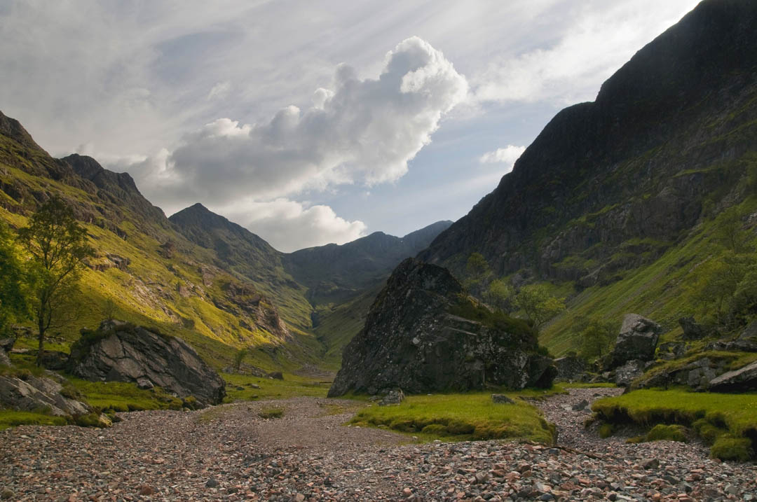
2.Lost Valley
Length: 4km, Time: 3 hours, Level of difficulty: moderate, Linear walk
Lost Valley is a traditional name of Coire Gabhail, a prolonged upper valley suspended under the high peaks of Glencoe. The valley is a famous Scottish landmark, as it was a place where the clan MacDonald hid their cattle from charging clan Campbell during the historic clan wars in Scotland.
We can only imagine how challenging it was to force the cattle to hike the rugged trail to Lost Valley. Nowadays the path still presents some challenge to keen walkers, not to mention grazing livestock.
Historic facts aside, why should you hike to Lost Valley and what is so special about it? The valley is accessible by a path from a spacious car park in the Pass of Glencoe. Having arrived to the car park you’ll face the iconic 3 Sisters of Glencoe, they’re 3 mountains divided by 2 suspended glens/valleys. Lost Valley is located a bit to the left and you should follow a path that leaves the car park’s left/eastern end. A path will first take you down to the spacious bottom the glen, only to rise gently towards the mountain slopes. Soon the trail joins a stream and follows closely while climbing up thru a low woodland. A climb to Lost Valley has some steep sections, but the main difficulty is keeping to the trail as it meanders among large boulders hidden between the trees. The trail suddenly emerges from the woodland into a sandy valley of a prolonged shape. Lost Valley is surrounded by iconic mountains, such as Gearr Aonach, Bein Fhada, Stob Coire Screamhach.
Retrace your footsteps to return to the car park.

3.Pap of Glencoe
Length: 7km, Time: 5-6 hours, Level of difficulty: moderate, Linear walk
Pap of Glencoe is the cone-shaped peak towering over Glencoe village, Ballachulish and Loch Leven. Its iconic shape is easily recognisable and seen from miles and miles away. Undoubtedly, Pap of Glencoe can be also described as a guard at the western end of Pass of Glencoe, while Buachaille Etive Mor (described further in the article) is a guard of the eastern end of the Pass.
A hike to Pap of Glencoe (Sgorr na Ciche) starts along single track road directly at the mountainside, but please keep in mind that the dedicated parking area is some 300 metres away, and you won’t be able to park directly at the trailhead. The trailhead is generally unmarked, but in the past it was signposted by a landowner, with ‘Pap of Glencoe’ on a white board, at the gate. However, this sign was missing in 2022.
If the parking area is busy or you’re based in Glencoe or Invercoe, consider walking to the trailhead rather than driving. From Glencoe village you’ll walk on a single track road all the way, whereas when coming from Invercoe area, especially if you’re based at the campsite, you’ll follow a mixture of muddy tracks (near Glencoe Lochan trails) and a paved single track road, quite easy to navigate.
PRO TIP: during our most recent hike to Pap of Glencoe, we walked to the trailhead from Invercoe campsite where we were based, it was a pleasant walk, approximately 1.5km
The trailhead is located at a gated track that will take you towards the grassy mountain slope. Pass the gate and you’ll already be on a mountain trail to Pap of Glencoe! As you can expect, a path to Pap of Glencoe is well-trodden and easy to follow, the initial section is maintained, however higher up the path becomes very rough, eroded and wet in places as it crosses several streams. To be honest, climbing the Pap can be quite challenging, and requires a lot of effort. Navigating, on the other hand is rather straightforward, once you pass the wooden bridge you’ll be on the trail that does not fork, just climbs steeply while zig-zaging on the mountainside.
Once you reach the high plateau under the stony hump of the Pap you’ll only have one final push before finally reaching the top! The trail climbs the top of Pap of Glencoe over loose rock and large slabs, somewhat ‘from behind’ and the final climb does not come too easy. Summit views are amazing thou! Enjoy magnificent view of Loch Leven, stunning mountains and small villages down below, while you’re standing with your head in the clouds!
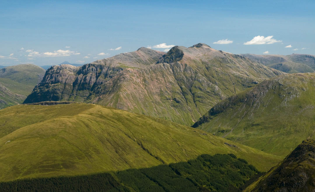
4.Bidean Nam Bian
Length: 12km, Time: 10 hours, Level of difficulty: very hard, Circular walk
Bidean Nam Bian is one of the hardest hikes in Glencoe area and should not be taken lightly. Completion of the 12 km route requires a significant elevation gain (over 1000 metres!), to scramble over rocky ridge and finally to negotiate some pathless ground.
Bidean Nam Bian massif consists of 3 peaks, which we recommend to climb, two of them are classified as Munros, hence you should expect a lengthy and hard day out. Along the route we’re recommending you’ll visit some of the most stunning hidden gems of Glencoe, such as Coire nan Lochan peak and Lost Valley.
You will be left breathless by the hiking effort as well as by the surrounding scenery! We mapped the route circular, with a beautiful ridge traverse – this section will awe you with overview of fairy tale Glen Etive and Loch Etive at the southern side of Bidean Nam Bian.
Hike to Bidean nam Bian is a fine outing, probably the best of Glencoe hikes; one of a legendary difficulty and scenery, preferably undertaken by seasoned walkers. In summer conditions you’ll have just enough daylight to complete the hike, however in winter you can expect considerable delays due to snow cover. As a matter of fact, a wintry hike to Bidean Nam Bian should only be attempted by experienced mountaineers, familiar with the terrain and local snow/avalanche conditions.
The difficulty of this hike should not discourage you from attempting the climb, however please be mindful and head out only when you’re well prepared.

5.Buachaille Etive Mor
Length: 14km, Time: 8-10 hours, Level of difficulty: moderate/hard, Circular walk
The iconic Buachaille Etive Mor stands proud at the eastern end of Pass of Glencoe, and is one of the most recognisable mountains in Scotland! The name Buachaille Etive Mor may look intimidating to non-Scots, however the mountain is also well known under a nick name of ‘Big Bookil’.
Hike to Buachaille Etive Mor is incredibly rewarding at any time of the year, but we especially enjoy it in autumn. With shorter days, a walker has a chance to enjoy the mountain views both during sunrise and sunset! Considering day length in mid-November: the day is only long enough for such a hike if you arrive to trailhead at sunrise. We appreciate that the stunning mountain may look intimidating at first, but this impression melts away as soon as you start the climb, it is not as incredibly steep as it seems from the car park, and the path is quite easy to follow.
Once you reach the high ground, at the the broad ridge, make your way to the highest peak of Buachaille Etive Mor, Stob Dearg. It is an amazing viewpoint, one that provides overview of endless Rannoch Moor down below, as well as to many famous mountains of Glencoe and beyond (including Ben Nevis!) The 5 km long summit ridge of Big Bookil traverses over 4 peaks, two of them classified as ‘Munro’, all of them connected by a good path and offering jaw-dropping views! For me personally, Buachaille Etive Mor is the very best hike in Glencoe, and ultimate hiking experience enjoyable without mad technical climbs and negotiating exposed sections.
Ensure to plan the hike in a way that gives you plenty of time to complete the whole ridge and descent before nightfall, for an average walker the hike would be most enjoyable between July and October, with enough daylight to complete the circular route without worry about time.

6.Buachaille Etive beag
Length: 8km, Time: 5.5-6.5 hours, Level of difficulty: moderate, Linear walk
Buachaille Etive Beag, the ‘Small Bookil’ is located next to its higher, famous sibling, Buachaille Etive Mor, but despite the convenient and incredibly scenic location, it is often overlooked. The mountain consists of two high peaks connected by a broad rugged ridge and is the best (and slightly easier) alternative to the long and hard hikes of Glencoe: Buachaille Etive Mor or Bidean Nam Bian. At the same time ‘Small Bookil’ offers very similar views and just as fine walking experience, with clear paths and incredible scenery.
Hike to Buachaille Etive Beag does not include any scrambling nor exposed sections and can be completed by most walkers, regardless of age or experience. This moderate difficulty hike will take you to the heart of Glencoe and offer mind-blowing views to surrounding mountains and further, to Glen Etive. It is not uncommon to spot herds of deer while climbing up to the ridge of Buachaille Etive Beag, or hear the deer calling, or even fighting over females (in rut season).
The trail to Buachaille Etive Beag is snow free most of the year, on average years it’s good to climb from late April to October, although you may come across leftover snow patches on high ground still in June (the patches should then be easy to walk thru or walk around). From the two peaks of Small Bookil we recommend to definitely put Stob Dubh (the further one) in your itinerary, as the other peak, Stob Coire Raineach is slightly steeper and requires more effort to climb.
Above all we recommend climbing both peaks, but should you have to choose only one, let it be Stob Dubh at the far side of the ridge.
A day hiking to Buachaille Etive Beag is a fine adventure with unforgettable views, and you will long to come back to this trail in other seasons!
7.Beinn a’Breithir
Length: 15km, Time: 7-9 hours, Level of difficulty: moderate, Circular walk
This fine hike starts from Ballachulish, a historic village over Loch Leven and covers 2 Munro peaks at the furthest end of Glencoe area. A classic, circular route will see you climb rugged ridge to the first summit, Sgorr Bhan, and further to the high top of Sgorr Dhonuil. Most of the route follows clear paths, especially on the high ridge between the two tops, however the initial climb, a section between green meadows of Ballachulish and Sgorr Bhan is very rough and includes a brief pathless meadow crossing to the ridge’s rock outcrops. Don’t worry thou, as the rougher sections are quite easy to negotiate and you’ll find your way easily. Just remember to stick to the top of the ridge whenever possible. The most iconic views Beinn a’Breithir has to offer is the incredible massif of Bidean Nam Bian in the east, Loch Leven directly below and finally Loch Linhe at the western end. This classic hike does not disappoint in any season, however we recommend late spring-summer-early autumn as the best times of the year to enjoy Beinn a’ Breithir.
The descent from high ridge is quite steep as it initially runs down a grassy slope and further enters the forest. Finally the path emerges from the trees in the village, near Ballachulish visitor centre- why not enjoy the well-deserved coffee and cake?

8.Aonach Eagach
Length: 10km, Time: 9 hours, Level of difficulty: hard/expert, Linear walk
Aonach Eagach is a name given to the narrowest ridge in Great Britain, which connects several high peaks over Pass of Glencoe. To traverse the famous Aonach Eagach ridge you require good hand on rock skills, good head for heights and great stamina. The hike is suitable for experienced walkers who will feel comfortable with considerable exposure and high drops on both sides of a narrow ridge. Even between Scottish hikers, the ridge is legendary for its difficulty and exposure, over the years many overestimated their abilities and ended up retracing their steps down to safety.
The hike begins at a small car park at the eastern end of Pass of Glencoe, initially it climbs steeply on rugged slopes to the first peak –Am Bodach. The challenge begins immediately as you descent the other side of Am Bodach, to the rugged high ridge with ‘crazy pinnacles’, rock outcrops over narrow ridge, that offer no by-pass and are very exposed to scramble over. Pass Meall Dearg and continue further along Stob Coire Leith, once you reach the top, the most dramatic and difficult part of the hike is completed, phew! However, you will still have to follow the ridge, now broader, all the way to Sgorr Nam Fiannaidh to be able to safely descent to low ground. The exit path is shared with the Pap of Glencoe trail and will take you down without any difficulties.
Aonach Eagach is notorious for accidents and moody weather. The difficulty of Aonach Eagach also lays in the fact that once you hit the ridge, there’s no escape routes, nor by-passes, you have to head straight on over the ridge. In wet weather the rocks become slippery, and some even ‘slimy’, which makes negotiating some sections hardly possible, definitely dangerous.
Keep in mind that the ridge hike is 10 km linear, ensure to plan means for returning to trailhead/car park. If the adventure of completing the legendary ridge walk sounds incredible, but you’re unsure, why not hire a local guide who will assist your traverse of Aonach Eagach?

Want more?
Check out our comprehensive guide:
- instant download
- 80 pages of detailed trail descriptions with hiking maps and stunning photos
- Google Maps coordinates for parking (QR codes)
- Information about public transport
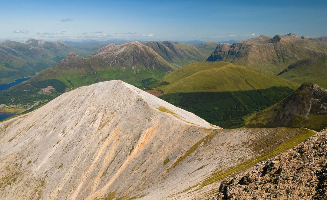
9.Creise and Meall a’Bhuiridh
Length: 11km, Time: 7 hours, Level of difficulty: moderate, Circular walk
Just before the Pass of Glencoe and directly to the east from the famous Buachaille Etive Mor is a duo of Munros: Creise and Meall a’Bhuiridh. You may have noticed a mountain just before Glencoe that homes a ski centre, with chairlift station visible at its foot. That’s Meall a’Bhuiridh. Due to their location next to the Big Bookil, Creise and Meall a’Bhuiridh are often overlooked, but don’t make this mistake! Both mountains offer stunning views and a fine hiking experience.
We think that the best way of conquering the duo is climbing Creise first and then progressing to Meall a’Bhuiridh, as it offers a good and straight forward descent path.
There are many possible routes up Creise, and of various difficulty. The easiest is hiking up and down along the same trail, from the ski centre car park, however personally we try to avoid linear routes and are very keen on circular ones, as they give the feeling of greater exploration.
For this very reason when tackling the Munro duo, we opted for a route that leaves the ski centre car park, follows the foot of Creag Dhubh and arrives to the lower slopes of Sron na Creise ‘from behind’. We discovered that this option may have been popular with local walkers as we found traces of path when walking around the corner of Creag Dhubh and further to the rugged foot of Sron na Creise. We picked the ascent up pathless Sron na Creise and although steep, the climb was not difficult. This particular section of the hike offers amazing views to Buachaille Etive Mor, the giant of Glencoe, with other magnificent mountains at hand! The amazing vistas kept us distracted from the thigh burn and in no time we reached the boulder plateau of Stob a’Ghlais Choire, only a couple of minutes walk from Creise itself. We can’t fail to mention spectacular scenery of Glen Etive that stretches for miles to the south-west.
Further hike was very easy and intuitive, we saw the route clearly as we approached the lower peak of Creise, which offers a passage to the other Munro, Meall a’Bhuiridh. Only 15 minutes later we topped Meall a’Bhuiridh, an easy ascent over rugged path. If you decided to follow our footsteps, you can choose the descent route under the chair lift, or slightly to the left, Alternatively you can use the chairlift and let your legs rest! Anyway, the way down will leave you speechless over the amazing landscape of Rannoch Moor right before you.
If such adventurous, bespoke route sounds too intimidating, you can choose to use the linear trail via Meall a’Bhuiridh and further up to Creise –this option offers good paths throughout and is easy to navigate. It offers just as stunning views and hiking experience!
10.Beinn a’Chrulaiste
Length: 7km, Time: 5 hours, Level of difficulty: easy/ moderate, Linear walk
The bulky statue of Beinn a’Chrulaiste rises directly opposite the great Buachaille Etive Mor at the very gate to Pass of Glencoe.
To hike to the top of Beinn a’Chrulaiste use the small car park at Altnafeadh, which also offers a trailhead. Despite being rather unnoticed and unpopular, Beinn a’Chrulaiste offers some of the best views in Glencoe and is very popular in cold seasons.
The route is pathless and climbs wet grassy slopes before levelling at the summit plateau; in our opinion the climb up is not particularly pleasant, but worth the effort. As soon as you top the mountain and enjoy the incredible vistas over Glencoe you’ll know why we thought Beinn a’Chrulaiste should take place among the best Glencoe hikes. Surely, the climb is easier and a bit more pleasant when the ground is frozen, more over Beinn a’Chrulaiste is known as a good winter camping and photo spot. Imagine looking over the Pass of Glencoe and surrounding majestic mountains in the sunset or sunrise light, or in cool pink and magenta of wintry evening. Some of the most beautiful photographs of Glencoe and Buachaille Etive Mor were taken during wintry hikes to Beinn a’Chrulaiste.
Although it’s possible to make the hike circular and descent towards the Kingshouse Hotel, we recommend retracing your steps back to the car park at Altnafeadh.
11. Stob Coire Nan Lochan
Length: 8.5km, Time: 6 hours, Level of difficulty: moderate, Linear walk
A hike to Stob Coire Nan Lochan was described by us in detail in the article about climbing the mighty Bidean nam Bian, its higher sibling.
Stob Coire nan Lochan is a giant towering at the far end of Coire Nan Lochan, upper glen. The top offers incredible views to the highest peaks of Glencoe, as well as overview of nearby glens and coiries. The best way to climb Stob Coire nan Lochan is to follow a well made trail initiating at the large car park in Pass of Glencoe (with helipad). The trail follows the stream before arriving to a bowl shaped area of the upper glen, Coire nan Lochan. This spot is particularly picturesque as it homes a couple of lakes and is overlooked by Pinnacle Buttress, a sculptured wall of rock. The most popular route up Stob Coire nan Lochan approaches the buttress and climbs up at the far end, where the rocks give way to grass. Alternatively you can take another approach and leave Coire Nan Lochan by a gentle climb over grassy slopes to the left, and further follow the ridge to the top.
Hike to Stob Coire nan Lochan is strenuous as it mercilessly climbs up from ‘step one’, almost as soon as you leave the car park. It’s particularly apparent on a hot summer day when you’ll just long to dip your feet in the cold stream along the trail rather than climb steeply to the top!
Retrace your steps to return to the car park, or you can make the route circular by climbing up to Stob Coire nan Lochan by a pathless grassy slope and the ridge, from the left, and returning by the path over Pinnacle Buttress.
12.An Torr and Signal Rock
Length: 2km, Time: 1-2 hours, Level of difficulty: easy, Circular walk

This easy walk at the bottom of Glen Coe visits an old woodland and Signal Rock, which accordingly to the legend was used to give signal to start the Glencoe Massacre in XVII century.
Although unmarked, the trail is easy to follow as it winds among tall trees, with occasional vistas to the high mountains. The trail is mostly flat, with only a small amount of ascents and descents, would be perfectly suitable for families with children or elderly visitors.
The trail starts at Clachaig Inn, where you can also leave your car and enjoy meal or refreshments after the walk.

13.Glencoe Lochan walk
Length: 2.5km, Time: 1-2 hours, Level of difficulty: easy, Circular walk
The Glencoe Lochan is often referred to as’ the gem of Glencoe’, as it is well hidden in an old woodland.
There are three marked trails, staring from the dedicated car park, Red (Lochan trail), Blue (Mountain trail), Yellow (Woodland trail). The Lochan trail, circular walk around the loch, is the easiest of the three marked trails with many benches scattered along lochside. Despite being a short and easy forest walk, it boast stunning views towards Mamore range and the nearest hill – Pap of Glencoe. If you’re looking for an easy stroll with beautiful views, this trail is for you!
The Red trail would be perfect for anyone, especially for a young family or elderly walkers.
For a more challenging option combine all three trails.

14.Altnafeadh to Kinlochleven via Devil’s Staircase
Length: 10km, Time: 3.5 hours, Level of difficulty: moderate, Linear walk
Finally we recommend a hike from Altnafeadh to beautiful Kinlochleven via famous Devil’s Staircase trail. This route starts at the Buachaille Etive Mor car park at the mounth of Pass of Glencoe and almost immediately starts to climb the steep slopes via a well-trodden trail. The zig-zagging path is easy to follow as it takes you higher and higher towards the mighty ridge.
You will gain height with spectacular view to Buachaille Etive Mor behind your back, so ensure to take breaks to admire the iconic Scottish landscape!
Quite suddenly you’ll reach a saddle between Beinn Bheag and Stob Mhic Mhartuin, the highest point of this route. At this point the views will blow you away and you’ll feel like you topped the world, however, the walk to Kinlochleven is still long, but mostly downhill. Having passed the saddle you will face picturesque landscapes of Loch Leven and Blackwater Reservoir areas.
This route requires some preparation, as it’s linear. You have to plan ow to get to the trailhead or how to return to the starting point; you can either use two cars, hitchhike back to Pass of Glencoe or use public transport.
HAVE YOU TRIED ANY OF THESE HIKES YET? WHICH ARE YOUR FAVOURITES?
LET US KNOW IF YOU THINK OF ANY OTHER TRAILS THAT SHOULD MAKE IT TO THE LIST OF THE BEST GLENCOE HIKES!
