
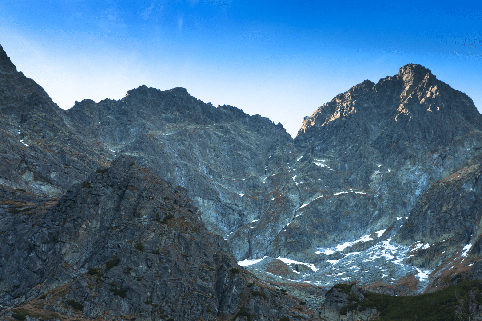
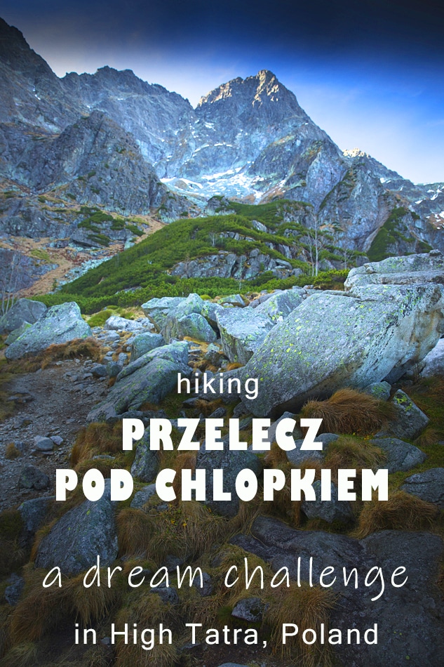
Hike to Mieguszowiecka Przelecz pod Chlopkiem (Przelecz pod Chlopkiem mountain pass) is famous for being one of the most challenging routes in Tatra mountains, and legendary for incredible views. The trail runs thru some of the most beautiful scenery in Tatra National Park – passes the world-famous Morskie Oko lake and takes you to the hidden corners of High Tatra range. During the hike to ‘chlopek’ (as it’s sometimes referred to) you’ll have the best views to Polish highest summit – Rysy, majestic massif of Mieguszowieckie group of peaks, crystal clear Morskie Oko and Czarny Staw pod Rysami mountain lake.
PRZELECZ POD CHLOPKIEM TRAIL – LEVEL OF DIFFICULTY
Despite its fame of being a ‘trail for experts’, we believe that most of experienced walkers will find it a great adventure in the mountains, even more – probably one of the best hikes in High Tatra and great alternative to overcrowded Rysy, in summertime. The main challenge while hiking to Przelecz pod Chlopkiem is a bit of exposure, but only a short section and nothing major. In the past the trail was not secured, however recently steel handholds and chains were fitted along the 2 steepest sections, making it easier to conquer. The route does not possess technical difficulty, and would be a fantastic (and rewarding!) challenge to any keen hiker with good head for heights and stamina to endure a 23 km walk with almost 1600 metres height gain.
Hike to Przelecz pod Chlopkiem – a dream challenge in High Tatra, fact sheet
- Height: Mieguszowiecka Przelecz pod Chlopkiem 2307 masl
- Total time: 10-11 hours
- Total distance: 23 km
- Total Ascent: 1581 metres
- Total Descent: 1581 matres
- Parking: Palenica Bialczanska, charge 25 PLN/day (click here for directions)
- Level of difficulty: 5/5 – very long hike with significant height gain, exposed sections, scrambling involved (a couple of handholds and chains)
- Przelecz pod Chlopkiem weather: weather forecast for Rysy
- Which map: Tatrzanski Park Narodowy (click to buy)
How to get to Przelecz pod Chlopkiem trail head
Trail to Przelecz pod Chlopkiem in Tatra starts from a large car park in Palenica Bialczanska. The car park fits hundreds of cars, but in high season fills up very early. The next nearest car park is in Lysa Polana, 1 km away. Daily parking charge on both car parks is 25 PLN (autumn 2018).
However, If you’re based in Zakopane, we strongly recommend taking public transport rather than driving to the trailhead as local roads are narrow and extremely busy.
The best way of getting to Morskie Oko from Zakopane is taking a mini-bus to Palenica Bialczanska. Mini-buses operate according to schedule and run regularly. In summer, during high season, best catch mini-buses at Zakopane train station or on early stops, as they fill up quickly. Cost of such journey is 10 PLN per person, duration approx 35-40 minutes. For comparison, taxi costs 100 – 120 PLN per course (prices valid in autumn 2018).
Facilities at Palenica Bialczanska: toilets, rubbish bins as well as fast food van and a small pub. At Tatrzanski Park Narodowy information point you can buy a map or postcard, but most importantly, will have to pay national park admission fee: 5 PLN per person (autumn 2018).

STAGE 1: WALKING FROM PALENICA BIALCZANSKA TO MORSKIE OKO
From car park at Palenica Bialczanska follow RED trail signposted to Morskie Oko. The trail actually is a 9 km paved road (traffic free) with several shortcuts thru the pine forest. Also, keep in mind that it’s extremely busy with tourists and walkers, therefore we recommend visiting Morskie Oko area early in the morning during summer months.
Although the trail follows Dolina Bialego Potoku valley, the view is partially obscured by the trees for most of the walk. There are interesting points along the way thou – one of them is a ‘Wodogrzmoty Mickiewicza’ waterfall.
The quickest we ever made it to Morskie Oko was 1 hr 15 mins, but anything short of two hours is a decent timing.
Please, don’t let the 9 km walk discourage you from hiking to Przelecz pod Chlopkiem! Area of Morskie Oko and Rysy is of such beauty, that everyone should visit it at least once!
On this hike we were joined by a fellow walker Jacek. By chance we arrived to the car park and hit the trail at the same time. We started chatting a bit and realised that we’re heading in the same direction. Very naturally we felt the connection and decided to spend the day in mountains together.

STAGE 2: HIKING FROM MORSKIE OKO TO CZARNY STAW POD RYSAMI
We arrived to Morskie Oko mountain hut after only 75 minutes walk; actually it was more like a trot than a walk, but we wanted to complete the first section as quick as we could. Knowing that we had a long and hard day ahead of us, we pushed hard; none of us have managed to reach Morskie Oko that quick before!
After a short break at Morskie Oko mountain hut, refreshed and satisfied with homely breakfast, we were ready to hit the trail again. And, it was still very early morning, just past 9 am!

Morskie Oko was still, not a single wave; like a mirror it reflected high rocky ridges of surrounding mountains. And the silence, oh, it was so quiet!
That was an absolutely amazing experience, as the lake tends to be extremely busy with people any time of the year, but on an early November morning we were alone.
Morskie Oko is not the only significant landmark along the trail to Przelecz pod Chlopkiem, the second famous landmark is Czarny Staw pod Rysami lake. It is located 45-60 minutes walk from Morskie Oko hut, signposted RED trail.
Path to Czarny Staw first runs along rocky shores of Morskie Oko, but when reaching the lake’s top, it forks. At this point you’ll face the first steep ascent. Although it’s only a 30 minutes climb over rough steps made of boulders, it’s steep enough to make your heart race.
Just when you get a bit tired, you suddenly reach Czarny Staw pod Rysami. I’m not sure why it’s called ‘czarny staw’ (black pond) as it’s actually green, but nonetheless it’s a beautiful spot. Many hikers make it their final destination when visiting Morskie Oko and Rysy area.
Oh, Rysy! Standing at the shore of Czarny Staw you’ll have a full view of Poland’s highest summit. Its slopes are directly opposite you and look cut in half (see photo below).

STAGE 3: FINAL ASSAULT – CLIMBING FROM CZARNY STAW TO PRZELECZ POD CHLOPKIEM
Couple of sips of water, and we were ready for the final assault. We left Czarny Staw and took GREEN trail, signposted to Mieguszowiecka Przelecz pod Chlopkiem.
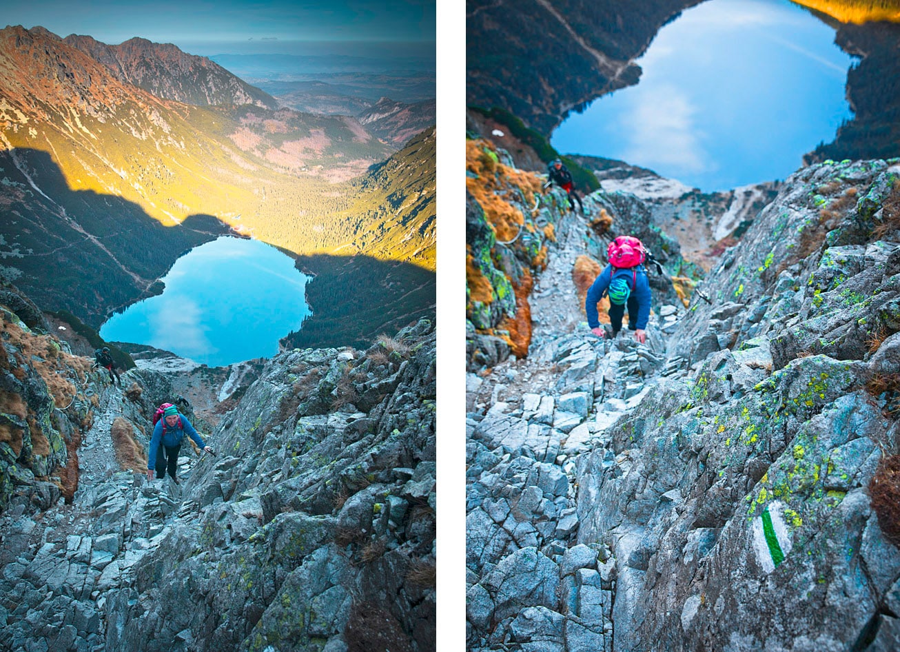
As this stage has a reputation of being very difficult, steep and dangerous, I ensured to take several photos to document it. I’m sure it will be helpful to many fellow hikers! You can also enlarge these photographs by clicking on them.

At first the path winds thru dwarfed mountain pine, gaining height gently. The trail is well made of large boulders and very easy to follow. But soon, as we left the dwarfed pines behind, the scenery changed and we entered a new world of grey, rough rock and low yellow grass. Also, with every step the trail became rougher. We didn’t even realise when it turned from a well made steps into a narrow, steep path winding amongst boulders.
Hiking in November, especially in a shaded area, we knew that sooner or later we will come across frozen sections, and indeed, all too soon we started seeing thin layer of ice covering the trail. Unfortunately, as we scrambled up we realised that some patches of ice were located at handholds and footholds, at times we struggled to safely go further.
Soon we also reached the famous ‘bad step’, known as the most dangerous spot along the trail. It’s a short section where one has to scramble up steeply and come to a narrow ledge. As you can guess, there is a rock wall on one side, the other side is a sheer drop. As scary as it sounds, it wasn’t extremely exposed, nor it felt very dangerous. There are steel handholds and chains fitted in the rock for security, but we didn’t think they were necessary. In fact, we passed this section and only later realised that it was ‘THE bad step’.
Keep in mind, thou, that good head for heights is required when hiking to Przelecz pod Chlopkiem, and if you don’t feel confident or comfortable, it’s better and safer to turn back. There are countless other amazing hikes in Tatra awaiting being discovered by you 🙂

The trail sharply turned left and we faced another steep scramble – to Kazalnica. That’s the only peak along the trail to Przelecz pod Chlopkiem, and actually feels more like a little viewpoint rather than a ‘peak’. Unfortunately, at this point we had to negotiate iced rocks more and more often, and for some of us it wasn’t fun anymore. Scrambling over steep, frozen rocks was a bit challenging, but we wanted to give it a go and see what’s ahead, hence we continued the hike.

Kazalnica turned out to be a truly fantastic viewpoint and I found it hard to leave the place! Just one more photograph, and one more and one more… but looking up to Przelecz pod Chlopkiem I felt excited and eager to conquer it.
The final ascent to the pass was easier than I anticipated. Or, I should rather say ‘would be easier than I anticipated’, but despite it being a relatively easy path, we came upon difficulties.
Just before reaching the pass itself, we had to follow a faint path along a narrow ledge. Although it wasn’t a scary narrow ledge with drop on one side, we struggled a bit, due to snow and ice. About 10 minutes before ‘chlopek’, we came to a stop and weren’t sure if we’ll make it thru. The ledge was covered by over a metre thick layer of ice, over a distance of about 100 metres. From afar it looked like snow, but when we came closer we realised that the thick white cover is rock solid ice, created by unfreezing and re-freezing of snow during previous weeks.
I admit, I had serious concerns about continuing further. Scrambling up over smooth, wet, slippery ice wasn’t a great idea. Especially that only hand and foot holds were the holes made by walking poles and boots before snow froze. Going up is always easier, but we had to remember that we will have to scramble down the same way.
Carefully, step by step we passed the ice and suddenly found ourselves on Przelecz pod Chlopkiem!

MIEGUSZOWIECKA PRZELECZ POD CHLOPKIEM – AN AMAZING VIEWPOINT
You can’t imagine our relief and happiness once we dropped the rucksacks and faced countless sharp ridges and valleys, standing at the Mieguszowiecka Przelecz pod Chlopkiem. Before our eyes were Slovak ranges and lakes, gently lightened by mid-day sun. I simply loved it! We were blessed with amazing weather too, sun was high and a very light breeze caressed our faces. It felt heavenly!!!
Loving the sight in front of us, we wanted to stay there forever! Jacek had something special for the occasion – we shared a beer and chocolate, had some sandwiches.
But, at the back of my head was the thought of negotiating the icy ledge on our way back and I couldn’t relax 100%.

RETURN FROM PRZELECZ POD CHLOPKIEM TO PALENICA BIALCZANSKA
I think all of us dreaded the icy section, and quite rightly. Eventually we scrambled down very carefully, ensuring to have the best grip possible in conditions given and guiding each other’s steps. As soon as we passed this icy section, we finally felt confident and all stress went away. Carefully we retraced our steps down to Kazalnica, took several more photographs and continued descending to Czarny Staw pod Rysami.

In no time we reached the mountain hut at Morskie Oko, this time we shared the spot with dozens other hikers. Oh, how lucky we were in the morning to have it all to ourselves!
After a hearty meal at the hut (and a well deserved beer!), we said goodbyes and Jacek continued down to the car park at Palenica Bialczanska, whereas Bea and I stayed overnight at the hut, planning another fantastic hike in the area next day – climbing Szpiglasowa Przelecz (Szpiglasowa mountain pass) and visiting Dolina 5 Stawow (Valley of 5 Ponds).
WHAT WE LOVED ABOUT HIKE TO PRZELECZ POD CHLOPKIEM
I never imagined I would enjoy the hike that much and that it would provide so much thrill! I must admit, I was hesitant to hike to the pass, because of its reputation of being extremely difficult. But once on the trail, I didn’t find it very difficult, quite the opposite – it was fun to scramble up steep granite rocks. And the views, oh my, they were mind blowing. I truly enjoyed the hike and I bet, if I’m in Tatra again, it will be high on my ‘to do’ list.
TRAIL TO PRZELECZ POD CHLOPKIEM, HIKING MAP

LOOKING FOR OTHER AMAZING HIKES IN HIGH TATRA? CHECK OUT THESE TRAILS!
If you’re looking for other challenging hikes in Polish Tatra mountains, check out these amazing walks! All include detailed route descriptions and hiking maps:
ZAWRAT – hike from Zakopane to Zawrat mountain pass and Dolina Pieciu Stawow. It’s a challenging trail and makes for a great introduction to scrambling in Tatra (security chains)
FROM MORSKIE OKO TO DOLINA 5 STAWOW VIA SZPIGLASOWA PRZELECZ – a long and challenging hike thru some of most spectacular scenery in High Tatra range. Involves scrambling down from high pass – Szpiglasowa Przelecz.
HIKING FROM HUT TO HUT IN TATRA NATIONAL PARK – a fine 6 day adventure! The route starts from Dolina Chocholowska and ends in Palenica Bialczanska at the eastern end of the national park. Along the way, you’ll pass some of the most iconic Tatra peaks and passes, as well as beautiful valleys!
Finding accommodation in Zakopane
You will be pleased to know that we thought about everything to make your visit in Zakopane nice and easy, hence it won’t come as a surprise that we even hand picked some fine accommodation options for you!
Head to Where to stay in Zakopane, our top 10 picks for ready, preselected accommodation for you. Booking your stay in Zakopane has never been easier!
*Level of difficulty explained: 1– easy walk, mostly flat 2-easy hillwalk, good path 3-moderate, possible some steep sections 4-long hillwalk, possibly some scrambling involved, possibly pathless 5-difficult, possibly pathless, long, requires technical skills

Great and informative post. And as always amazing an inspiring photos! I will definitely try make this in summer to avoid ice on the trail . I am si scared of hights that a minor challeng like that could make me panic 😉