
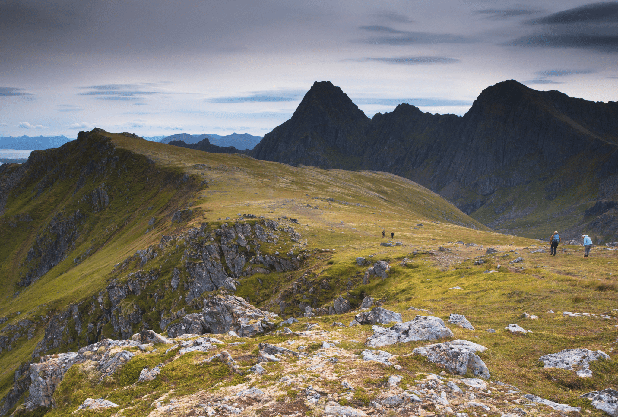
Dronningruta is best known mountain hike in Vesterålen archipelago. Also called The Queen’s Route, this trail should be on ‘to do’ list of every keen walker visiting Northern Norway. It seems that Dronningruta is a ‘love or hate’ route, we heard voices of either high praise or total dislike. We were curious of it, so we headed to village Stø to find out which opinion of Dronningruta hiking trail was right. Continue reading to see what we thought about it!
Dronningruta Vesteralen – hiking The Queen’s Route fact sheet

- Height: Sørkulen 518 masl
- Total time: 6 hours
- Total distance: 15 km
- Parking: car park in Stø (directions)
- Level of difficulty: 3/5 -moderate, long hill walk with some steep sections. Norwegian standards: RED – demanding.
- Dronningruta weather: Sørkulen weather forecast
- Which map: Vesteralen (click here to buy)
How to get to Dronningruta trailhead
You can start Dronningruta hiking trail either in a small village Stø, at the northernmost tip of Langoya island or in a tiny settlement – Nyksund. We recommend beginning in Stø. Although road to Stø is narrow, it’s still much better and shorter drive than road to Nyksund.
The Queen’s Route begins just past Sto; there are three possible parking spots – all located along the road between the village and campsite (where the road ends).
Stø is a small village, mostly known for whale watching sea safaris (see information on bottom of page), and as much as it is increasingly popular with visitors, it’s rather unprepared to fit hundreds of tourists at once. Therefore, we believe it could be tricky to find a parking space in summer.

Hiking Dronningruta from Stø
Dronningruta trailhead is located at road bend, near small hut and tiny parking bay – fitting up to 4 cars (exact location). Although in the village we noticed a signpost ‘Dronningruta start point 0.8 km’, car parks are not marked, neither is the trail head.
Queen’s Route starts with steep ascent on eroded path. Despite unmarked trailhead, the path is well defined, signposted along the ridge and marked with red ‘T’ (standard Norwegian route markings). Thanks to the markings, navigation along Dronningruta was very easy!
Very soon we climbed the steep slopes, and found ourselves in open space – at the very beginning of mountain ridge. We continued up, long but gentle ascent took us to first mountain of the day – Nonstinden.

Bea and I really love ridge walks; most of them are plentiful in fantastic views in every directions. Most importantly, after the initial great effort to reach the ridge, further hiking is usually easy and enjoyable. Dronningruta didn’t disappoint in this respect! What we also liked about this trail – most summits we encountered on the way, were gentle bumps – easy to climb.

With ease, we passed Gjuraheia and Kjølen – both felt more like ‘bumps’ than mountain summits.
Ridge spine changed direction and narrowed, first time we noticed two lakes far below, to the right. In front of us, was the highest mountain of Queen’s Route, Sørkulen, just over 500 metres high. Officially, Dronningruta omits this mountain, path cuts across the slope to the saddle at other side of Sørkulen; climbing to the top is optional.
We have opted to climb the peak and followed faint path towards Sørkulen summit. I’m still wondering why the marked path omits the highest mountain along the trail…? It feels very natural to continue along the ridge and climb to the top; what is more – in our view Sørkulen is a fantastic landmark, perfect to have a break and to enjoy scrambling on your way down.

Without much effort, we reached the summit of Sørkulen, 518 masl.
A large cairn (pile of stone) protected us from wind; we were ready to have a first break. Obviously, sandwiches and hot tea popped from Bea’s rucksack! While having snacks, we had a look around.

To the south were Vesteralen’s marshlands and swamps; stretching over horizon were mountains, mountains and more mountains!
Sorkulen’s western slopes were steep, we were careful descending over loose rocks. In no time we got to the saddle and joined the main path (the one we ignored on the approach).

Before us, were rugged slopes of Finngamheia, which we climbed without much effort. At that point, we felt that the rest of hike will be less exciting – we only had one other bumpy summit to climb, then descent to coastal path taking us back to Sto.

Suddenly, a group of Norwegian hikers appeared on the horizon! How did we recognise them to be Norwegian? During the 2 months we travelled in Norway, we noticed that local walkers dress very characteristically – their hiking clothes and gear are usually very brightly coloured! Hikers in no other country wear such colourful jackets, tights, trousers, rucksacks, shoes!
They were coming from opposite direction, began hiking in Nyksund; we chatted a little and continued each their own way. As the day was relatively warm (as for arctic islands!), we enjoyed the ridge walk a lot and were in no hurry!

All too soon we were descending from Finngamheia!
On the contrary to what we anticipated about the last part of ridge walk, it was exciting! Final descent from small bumpy summit to the saddle (where our return path began) was over a narrow, rocky ridge – path descended steeply to the saddle – we enjoyed it a lot! Not to mention that we didn’t expect such an adventurous section, we welcomed it with joy!

Dronningruta is sometimes described as Stø to Nyksund hike. It is, however a little bit misleading, as to visit Nyksund, we would have to leave the main trail at the saddle, descent to the village and then return the same way to the saddle to continue to Sto. We didn’t really fancy that, therefore we skipped visiting this tiny settlement.
Instead, from saddle, we descended east, towards large lake. At first path was muddy, with tree roots sticking out, this section required great care.

Return to Stø
Last, least exciting part of Queen’s Route, was returning to Sto along coastal path; but as we all know – returns are always least favourite.
Coastal trail was very wet in places. Fortunately, there were wooden boards and footways in wettest sections. Hiking back was, however, a slog.

Only two spots along coastal path are worth a mention: small beach near Sto and an open shelter, Enge. They were a nice surprise, especially when we realised that we have company on the beach! Unbelievable, but there were ocean swimming enthusiasts, 69 degrees north!!! Oh boy, they were tough!
Dronningruta’s coastal part returns to Sto at the campsite – some 500 metres from the heart of village, at the very end of road.
Whale watching safaris from Sto
Vesteralen archipelago is one of the best locations for whale watching, all year round! You can join a boat or rib trip to see whales in Andenes and Sto. Depending on the season, you can spot different kinds of whales – in summer you’re most likely to spot sperm whale and maybe some orcas (killer whale), in winter you can admire humbpack whales (jumping out of water!) and orcas.
It’s important to do a bit of reading prior to booking your trip, to avoid disappointment. I was very set and excited on the thought of whale spotting trip, however after realising that in summer I would be most likely to see only sperm whales, I decided to drop the idea.

Wild camping near Dronningruta and nearest campsites
Wild camping in Vesteralen (and all of Norway) is allowed and widely accepted. By law, everyone is allowed to stay overnight at any spot at least 150 metres from nearby buildings. Vesteralen are sparsely populated, therefore it’s very easy to find a suitable wild camping spot for a camper van or a tent – even along the road. If you’re considering staying overnight along Dronningruta trail, you’ll have no problem whatsoever to find a bit of flat and dry ground, although please note that the ridge tends to be windy. Also, keep in mind that grounds along coastal path were very wet.
Nearest campsite is located in Sto – at the very end of road (you’ll pass it on your return). This campsite, however, is known for its poor facilities, and we chose another one instead.
We stayed at Oppmyre Campsite (website) and (directions) and can totally recommend it! In fact, we think that Oppmyre Campsite was one of the best we ever stayed. Not only it’s beautifully located at the sea, with views to mountains, but also the facilities were great! Campsite kitchen and living room were very clean and of such high standard, it actually felt like using somebody’s home. We stayed at the campsite for two nights; first evening we chilled out in the living room, listening to music and working on laptop. The campsite is small, owners are very friendly and the atmosphere is relaxed.
While driving to the top of Langoya island, we passed at least 6 other campsites, located between Sortland and Myre; we feel, however, that staying at Oppmyre was worth driving extra miles.


Droninngruta hiking map

What we loved about hiking Queen’s Route in Vesteralen
Dronningruta is a fantastic ridge walk! The trail is easy to navigate, marked and doesn’t require technical skills nor high level of fitness, although it’s rather long. It also has a feel of being remote and quiet – we only met couple of other hikers. Highlights of the trail were hiking the ‘extra summit – Sorkulen’ and the narrow, rocky section of descent to the last saddle. We greatly enjoyed hiking Queen’s Route and definitely recommend it!
*Level of difficulty explained: 1– easy walk, mostly flat 2-easy hillwalk, good path 3-moderate, possible some steep sections 4-long hillwalk, possibly some scrambling involved, possibly pathless 5-difficult, possibly pathless, long, requires technical skills
NORWEGIAN DIFFICULTY LEVEL EXPLAINED: GREEN – easy , BLUE -moderate, RED – demanding, BLACK -expert
