

Bruach na Frithe is one of the many dramatic peaks that form the Black Cuillin ridge—a towering, jagged alpine range on the Isle of Skye, renowned for its sheer exposure, dizzying drops, and formidable difficulty. The Black Cuillin’s fearsome reputation may deter some hikers and scramblers, but for adventure-seeking climbers, it acts as an irresistible lure.
In this article, we aim to show you that these rugged, spire-like summits have a gentler side. With the right approach, you too can set foot on the Black Cuillin ridge and take in some of the most breathtaking views Skye has to offer.
Take a look at the photograph above—we’re standing at the very summit of Bruach na Frithe, one of the peaks of the Black Cuillin. It hardly looks intimidating, does it?
Situated west of Am Basteir and its distinctive, much-photographed ‘tooth,’ Bruach na Frithe (BnF) shares the same general location but remains hidden from view at Sligachan, only revealing itself from vantage points farther west.
Read on to discover how to reach the summit of Bruach na Frithe, what to expect along the way, and how to conquer this remarkable peak on the legendary—and often elusive—Black Cuillin ridge. You can follow our guidance with confidence; every piece of advice is based on our firsthand experience. We’ve done it ourselves, and now we’re here to help you do the same!
We’re sharing a hiking map with marked trail, describe the route in detail so you can be confident on your quest to conquer Bruach na Frithe or access the iconic Black Cuillin ridge!
Hike to Bruach Na Frithe, Black Cuillin Ridge, Isle of Skye. Fact sheet
Height: 958 masl
Total time: 5-6 hours
Total distance: 8 km
Parking: 2 parking laybys along road to Dunvegan A863 (directions)
Level of difficulty: 4/5 4/5 no scrambling involved, exposed sections only optional, includes negotiating rocky terrain, prone to mist
Bruach na Frithe weather: weather forecast for Bruach na Frithe
Which map: Ordnance Survey Explorer 411 Cuillin Hills
How to get to Isle of Skye
The Isle of Skye, located off Scotland’s west coast, is one of the country’s largest and most spectacular islands. The easiest way to reach Skye is by car, and most visitors opt to drive.
Conveniently, Skye is connected to the Scottish mainland by the Skye Bridge, which links Kyle of Lochalsh to Kyleakin—eliminating the need for a ferry crossing. If you don’t mind a long drive, getting to the island is relatively straightforward. By “long,” we mean approximately 4 to 5 hours, depending on your pace. (Yes, your navigation is correct—the fastest route runs via the A9!).
Having visited Skye multiple times, we’ve found that the average journey time from Edinburgh to the Skye Bridge is exactly 4.5 hours. A similar travel time can be expected from Glasgow. We mentioned these cities because most visitors to Scotland arrive via Edinburgh or Glasgow.
While driving is the most convenient way to reach Skye, public transport is also an option. Although there is no direct train service from Edinburgh or Glasgow to Kyle of Lochalsh, you can take a train to Inverness and transfer there. From Kyle of Lochalsh, buses provide easy access to the island. Similarly, if you prefer to travel by bus, you will need to route through Inverness—fortunately, Inverness is well connected to other Scottish cities.
For those who want to add to the adventure, taking a ferry to Skye is another possibility. The most popular ferry route runs between Mallaig and Armadale, while Skye is also connected to the Outer Hebrides via a ferry from Uig to Tarbert.
There are no airports on the Isle of Skye, with the nearest international airport located in Inverness.
How to hike to Bruach Na Frithe and Cuillin Ridge (finding the trailhead)
The hiking trail to Bruach na Frithe offers a fantastic and accessible route onto the Black Cuillin ridge. While the terrain is relatively straightforward and requires no scrambling, navigating the path can be challenging in misty conditions. That said, the average walker should have no trouble reaching the summit!
PRO TIP: We recommend hiking to Bruach na Frithe from Sligachan, but another excellent starting point is the Fairy Pools car park in Glen Brittle. The two routes differ only in their initial approach, so if you’d like to combine summiting this Black Cuillin Munro with a visit to the stunning Fairy Pools, this could be the perfect option for you.
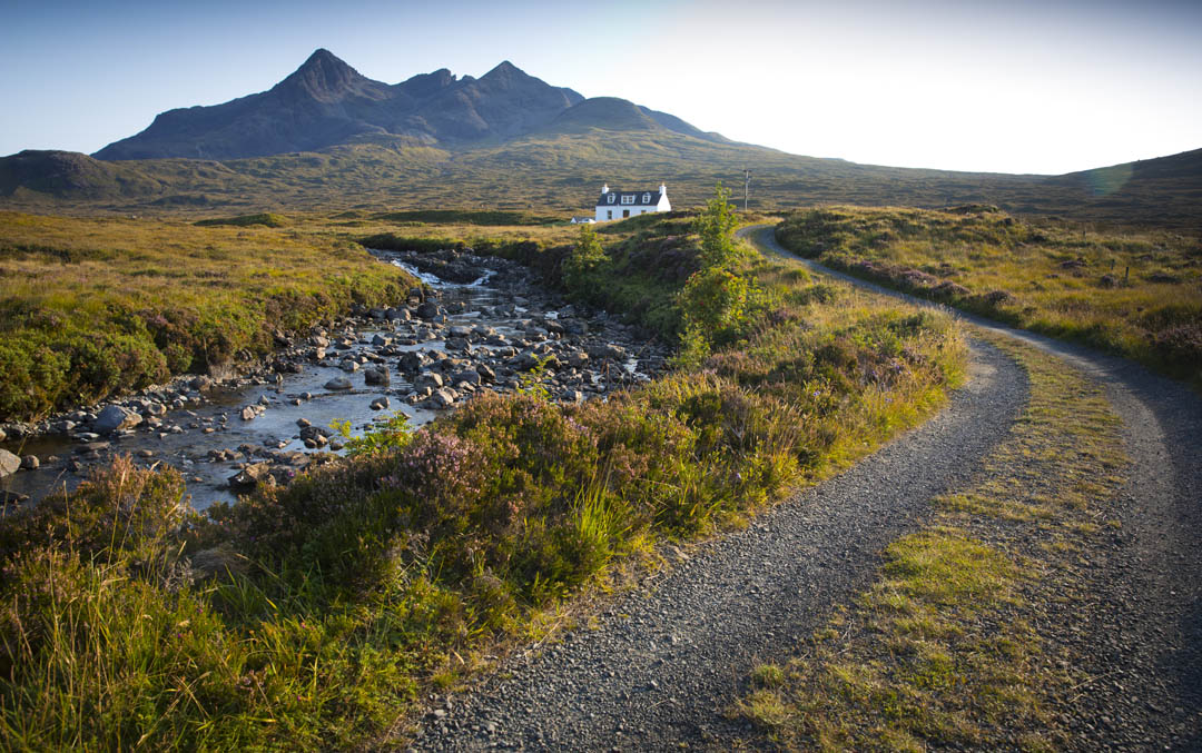
As for the Sligachan route, the most convenient parking is in one of two laybys along the A863 road to Dunvegan. The best option is the layby located 0.5 miles from the Sligachan junction, just past the track leading to a small white cottage. If this parking area is full, head back towards Sligachan and try another layby on your right, not far from the Sligachan Mountain Rescue base.
Related: 30 best hikes in Scotland

Planning a trip to Isle of Skye?
Get our ultimate e-guide:
- 370 pages
- Google map with QR codes
- detailed description of 26 hikes with maps
- beautiful photographs to inspire your trip
Climbing to Bruach Na Frithe on the Black Cuillins Ridge, what to expect
When you arrive at the parking area, look for a wide track leading toward a distant white cottage—this marks the starting point of the trail to Bruach na Frithe.
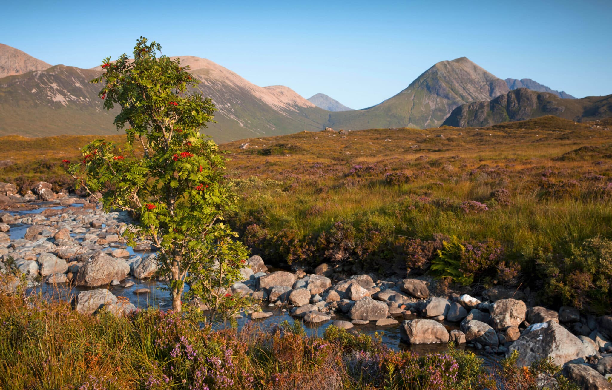
Just before reaching the cottage, you’ll spot a signpost labeled “Path” on the right. This is where you should leave the track and follow a well-trodden trail that gently ascends through the moorland. Unlike many moorland paths, this one is surprisingly dry and easy to follow. Before long, it runs alongside the rushing waters of Allt Dearg Mòr, a picturesque stream with beautiful cascades and pools reminiscent of those at Glen Brittle—yet still a hidden gem, largely unknown to the general public.


Follow the path as it winds alongside Allt Dearg Mòr—you’ll hardly notice you’re gaining elevation! The rushing cascades and sweeping mountain views provide the perfect distraction.
As the anticipation of reaching the legendary Cuillin ridge builds, you’ll catch your first glimpse of Bruach na Frithe in the distance. Previously hidden behind a towering Cuillin peak, it finally reveals itself as you continue your ascent along the stream.
Upon reaching Coire na Circe, keep an eye out for an unmarked fork in the path where the trail crosses the stream. Though there’s no cairn to mark it, the continuation of the trail on the other side of Allt Dearg Mòr is clearly visible and easy to spot. In fact, this fork may appear to be the main trail—far more walkers take this route toward the mountains than continue straight toward Glen Brittle. This is also where the Glen Brittle route merges with the path leading to the summit, so from this point onward, the route description applies to both starting points.
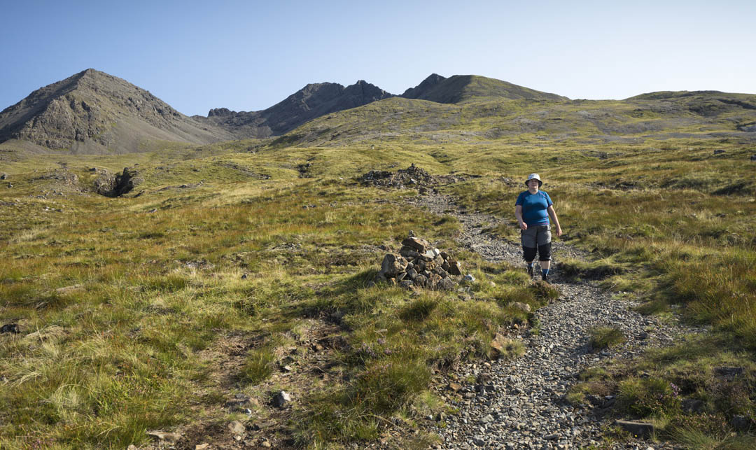
After crossing the stream, continue along a wide path of grass and loose stones, occasionally marked by cairns. It takes you towards the mountains, steadily climbing over bumpy ground.
Important note: should you miss the fork at Coire na Circe you’ll end up walking all the way to Fairy Pools! (which isn’t a bad destination at all, just not what you planned)

The stony trail winds uphill and is very faint in places, don’t worry if you loose it briefly, simply walk towards the bowl of Fionn Choire filled with boulders and loose rock.
Before the terrain dramatically changes its character to rough rock and boulders you’ll find a small waterfall and a pool (on the left), this is the last spot to replenish drinking water! Remember to fill up the water bottle before further hike!

After passing the waterfall, you’ll reach an area with large boulders—an ideal spot to take a break or have lunch. From here, the trail becomes trickier to navigate, especially in mist. A faint path climbs steeply toward the ridge, keeping to the left, close to the rugged slopes of Sgurr a’ Bhasteir (see photo above).
If you lose the path, don’t worry—simply continue uphill, aiming slightly left of a small rock tower on the ridge (the point above Beata’s head in the photo). Before long, you’ll reconnect with the trail.
Just before reaching the Cuillin ridge, watch for a path branching left beneath a crag. Consider taking a short detour to Sgurr a’ Bhasteir—this additional summit offers spectacular views of the famous pinnacles of Sgurr nan Gillean. The round-trip detour adds roughly an hour to the hike. After taking in the views, return to the junction beneath the crag and continue right, ascending toward the Cuillin ridge.

The photo above reflects the exact spot where you join the Cuillin ridge at the Bealach nan Lice. Wow, what an impressive location!
Well done, you have now climbed to the legendary Black Cuillin ridge, how does it feel to stand in such mighty high spot? Awesome?! And you didn’t even have to use hands to get there!
Our experience: When we stepped on the Cuillin ridge we felt so elated it’s hard to describe! I think I explored every viewpoint, I was careful not to overlook a stunning photo opportunity. All this from a safety of a broad ridge 🙂

It won’t be long before you set your eyes on the destination of the day, Bruach na Frithe. The peak is only a short walk away from the ridge access point under Am Basteir, and reaching it takes roughly 20 mins. Keep to the left when tackling the summit, the ascent is easier this way. You’ll be able to see several faint paths leading up, they all climb steeply over loose rock and outcrops.
Remember to turn around when climbing to BnF. The view changes with every step and is more and more impressive as you gain height.
Some breath-taking examples below:


I expect you’re already lacing your walking boots and getting hiking poles ready for the ultimate Cuillin ridge adventure for walkers!
Don’t hesitate, consult the weather forecast on the best day for stunning mountain views and go! Explore! Climb Bruach na Frithe with confidence!

You may have already looked at the mighty BnF during your visit to Fairy Pools. The peak is located directly over the famous pools and cascades, but somewhat shy and often covered by clouds.
I will never forget the feeling of standing on the top of this Munro with Coire Creiche and Fairy Pools at my feet, and crowds oblivious to the fact that they’re being watched from above.
Now, having conquered the impressive summit, the fun is far from over – you still have to get back 🙂
The most obvious is retracing your steps via Fionn Choire (any many do), but we suggest another route, way more adventurous! (photo below)
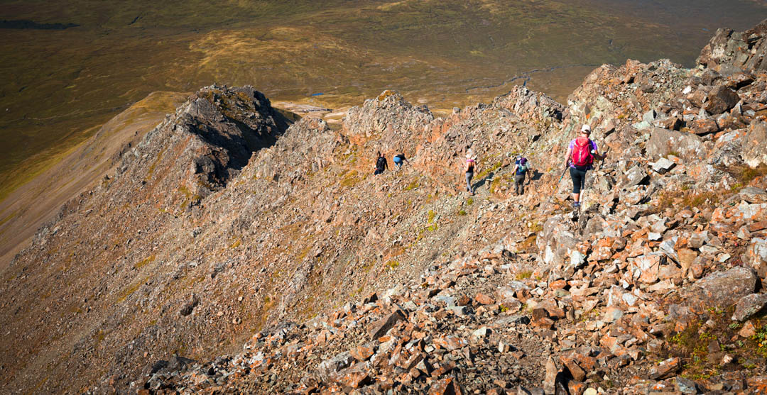
Some describe this route as ‘moderate scrambling’, but in fact there is a fine path all the way along the North-western ridge of Bruach na Frithe, and only requires “hand use” on a few occasions 🙂 and as always – care. Remember to take short breaks to admire the scenery rather than walk and look at the same time, keep your eyes on the path ahead!

To recap, we recommend descending from Bruach na Frithe via its northwest ridge, where you’ll find a rough but clearly defined path. The ridge eventually levels out into a grassy meadow, where the path fades. When this happens, simply follow the gentle grassy slope downhill to the right. In about 15 minutes, you’ll rejoin the main trail near the small waterfall you passed on the ascent.
From there, follow the well-trodden, rocky path downhill toward the main route along Allt Dearg Mòr. At the trail fork, keep right to return to the white cottage and the layby at Sligachan.
PRO TIP If you’re planning your hike on a calm summer day, be prepared for swarms of relentless, bloodthirsty midges—especially between the trailhead and the fork. Based on our own experience, a midge net is invaluable in this section, so be sure to bring one along!
Bruach Na Frithe hiking map


You can also use this online map to follow the way from Sligachan to the top of Bruach na Frithe, but note it only indicates the ascent, not descent route.
What we loved about the hike to Bruach Na Frithe
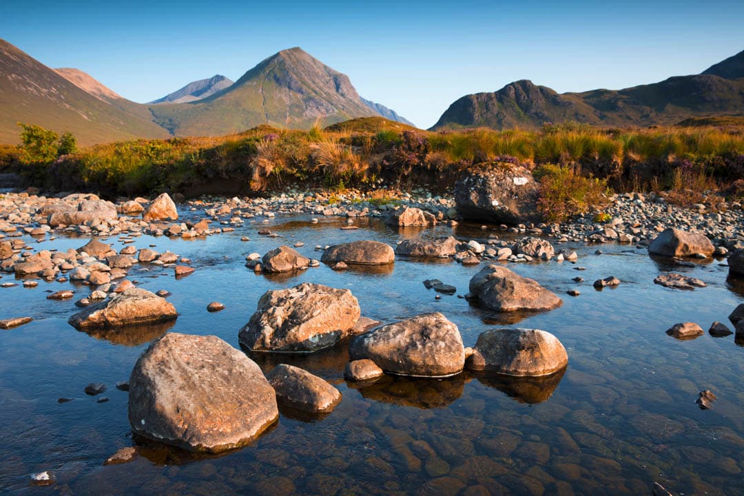
We particularly enjoyed the views from Cuillin ridge and BnF top, it felt epic to stand on the legendary Cuillin ridge! The scenery and views seemed even more magnificent when compared to the moderate effort we had to put to climb the mountain! Indeed, it wasn’t a very hard hike but what we got in return left us awed and speechless. The experience of walking to the Cuillin ridge and the clear path all the way up was a great help and we felt that navigating (on a clear summer day) was straight forward.
Undoubtedly, we would recommend this hike to a friend (doing it just now!) and would gladly revisit this little known corner along the Cuillin ridge!
Wild camping near Bruach Na Frithe, nearest campsites and accommodation
A keen eye will spot countless good tent pitching spots along the way to Bruach na Frithe, especially past the ‘fork’. The initial section offers some nice spots along the stream, but the ground is generally very wet and the midges are fierce. Due to the rocky terrain and ever-changing weather conditions we discourage from staying overnight at the Cuillin ridge.
Campers and motorhomes, please refrain from parking overnight at the laybys at trailhead. Please be considerate and keep in mind that the laybys fill up early in the morning with many walkers coming to tackle Bruach na Frithe. If you happened to return from the mountains late and decided to sleep at the layby (searching for a suitable overnight parking spot in the dark is no fun!), ensure to leave very early the next day to make space for walkers. Thanks!
The nearest and most obvious campsite is the Sligachan Campsite, but remember to check the availability (the campsite was closed 2020-2021 due to Covid. Phone +44 1478 650204). Another relatively close campsite is located at the farthest end of Glen Brittle. This one does not take bookings (it’s first come first served. Phone +44 +44 1478 640404) but you can expect to get the space if arriving in early afternoon. Be warned that the access road to Glen Brittle Campsite is in a terrible state, with lots of massive potholes, especially the final bit.
Other options are Torvaig Caravan and campsite near Portree, or Skye Camping in Broadford.
When it comes to accommodation, Isle of Skye offers anything from luxurious hotels to glamping cabins. We handpicked some accommodation for you, see below (via Booking.com):
| Accommodation | Rating | Comment |
| Sligachan Hotel | 7.9/10 | conveniently located, clean & comfortable, great value, stunning views |
| Breakish Escape | 9.5 /10 | great location, mountain and sea view |
| Portree Youth Hostel | 8 /10 | located in Portree, only 20 mins drive from Sligachan |
| Seafar Bed and Breakfast | 9.3 /10 | quiet location in Portree |
| Broadford Hostel | 7/10 | convenient location for public transport |
*Level of difficulty explained: 1– easy walk, mostly flat 2-easy hillwalk, good path 3-moderate, possible some steep sections 4-long hillwalk, possibly some scrambling involved, possibly pathless 5-difficult, possibly pathless, long, requires technical skills
