
Without a doubt, the UK boasts some of the finest coastal walks in Europe. The coastline of Great Britain alone – the mainland, excluding Northern Ireland and offshore islands – stretches over 11,000 miles (18,000 km), offering an extraordinary wealth of opportunities for coastal exploration. If you include Northern Ireland and the many surrounding islands, the sheer number of trails is enough to satisfy even the most enthusiastic hiker.
Coastal walking wasn’t always our first choice, but in recent years, we’ve developed a deep appreciation for it. Our adventures along Britain’s shores, particularly our recent trip to Shetland, have only heightened our love for these breathtaking landscapes. There’s something undeniably magical about walking along the coast – the endless horizon where water meets sky, the invigorating sea breeze, the towering cliffs plunging into wild, untamed waters, the hidden coves with pristine white sand, and, of course, the ever-present company of seabirds. We’ve fallen in love with the British coastline, and we hope this article will inspire you to explore some of its most remarkable trails.
The UK offers an array of spectacular long-distance coastal trails, many of which can be completed over several days. However, you don’t need to embark on a multi-day trek to enjoy the coast – there are countless opportunities for shorter day hikes as well. The choice is entirely yours.
So, without further ado, in this latest installment of our Hiking in Europe series, we’re excited to share some of the very best coastal walks in the UK.
Hiking in Europe: 14 best coastal walks in the UK to be discovered by you in 2024
1.Hermaness National Nature Reserve, Unst island, Shetland, Scotland
2.St Ninian’s Isle, mainland Shetland, Scotland
3.Papa Stour, Shetland, Scotland
4.Old Man of Hoy and St John’s Head, Hoy island, Orkney, Scotland
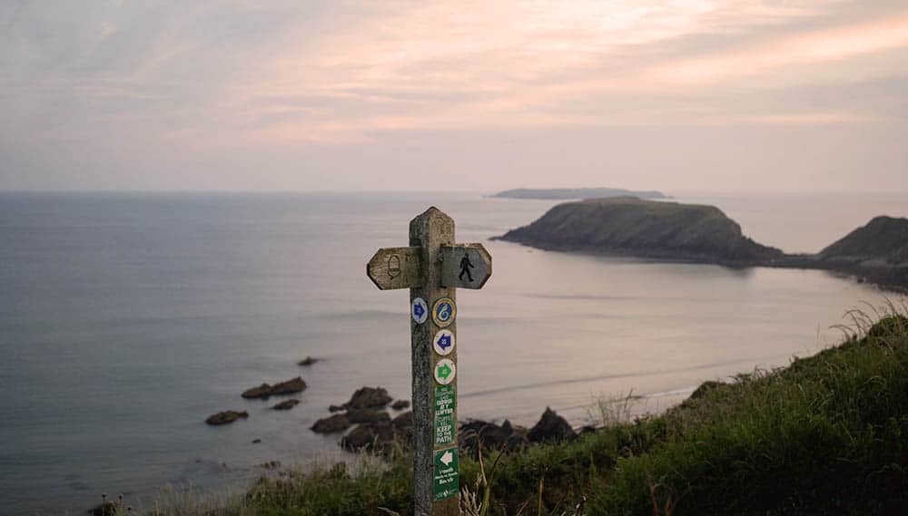
5.Pembrokeshire Coast Path, Wales
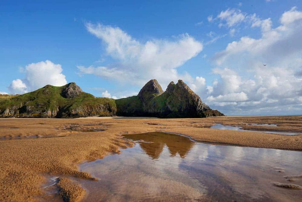
6.Gower Peninsula Coastal Path, Wales
7.Seven Sisters, South Downs National Park, England
8.Norfolk Coast Path, England
9.The Lizard Peninsula, Cornwall, England
10.Filey to Bridlington, Yorkshire, England
11.Lulworth Cove and Durdle Door, Jurassic Coast, England
12.Pilgrim’s Way and Holy Island of Lindisfarne, Northumberland, England
13.Causeway Coast Way, Northern Ireland
14.The Gobbins, County Antrim, Northern Ireland
Coastal walks in Scotland
1. Hermaness National Nature Reserve, Unst island, Shetland
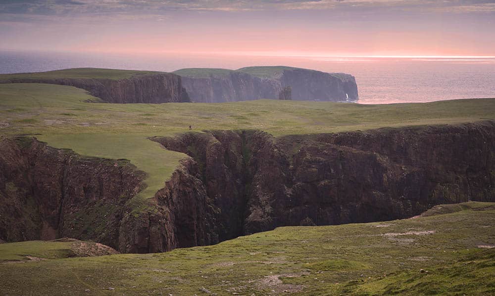
Without a doubt, Shetland’s coastline is the most spectacular in the UK – though we might be a little biased, having fallen in love with the archipelago during our time there. What makes Shetland so special is the sheer variety of its landscapes; each island has its own distinct character. From the dramatic volcanic cliffs of Eshaness to the west coast of the mainland, where towering sea stacks rise from the waves, every walk feels like a new adventure. And if you visit during the breeding season (April – July), you’ll be in the constant company of seabirds on every trail.
Hermaness: A Wild and Untamed Paradise
Hermaness is one of Shetland’s truly remarkable places, and it was the first stop on our trip – setting the bar exceptionally high. Reaching Hermaness requires two ferry crossings, first from the mainland to Yell and then from Yell to Unst. But the journey is well worth it. The towering cliffs of Hermaness are home to more than 100,000 birds during the breeding season, including a vast gannet colony, countless puffins, and the world’s third-largest population of great skuas (bonxies).
From the car park, a 10 km (6-mile) circular walk leads through the nature reserve, combining a well-constructed boardwalk (made from recycled plastic) with grassy coastal trails. We strongly recommend allowing plenty of time for your visit – you’ll find yourself stopping again and again to marvel at the sweeping views and the incredible birdlife.
The Route
Begin your walk by heading towards Neap, the viewpoint overlooking the gannet colony. After taking in the spectacle, retrace your steps north to continue along the coast toward the striking, jagged rocks of Muckle Flugga, with its remote lighthouse, and Out Stack – the northernmost point in Britain. The trail is easy to follow, though some sections can be muddy, so sturdy footwear is advisable.
On the return from the Muckle Flugga viewpoint, take the hill path for even more breathtaking panoramas while slightly shortening the route back.


2. St Ninian’s Isle, mainland Shetland
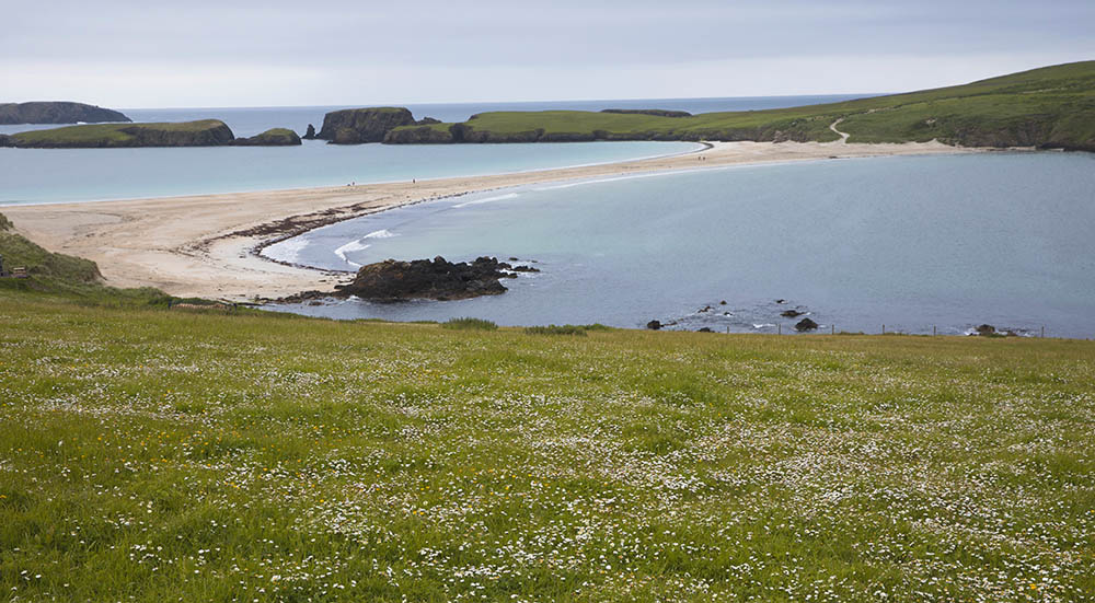
Before setting off for the coastal walk around St Ninian’s isle you can admire the largest active sand tombolo (a beach or bar created and maintained by wave action that connects two landmasses) in the UK.
‘The 500m long sandy tombolo at St Ninian’s is subject to waves from two opposing directions. They break simultaneously along its length, resulting in beautifully symmetrical sweeping beaches facing north and south’ (source: Shetland Amenity)
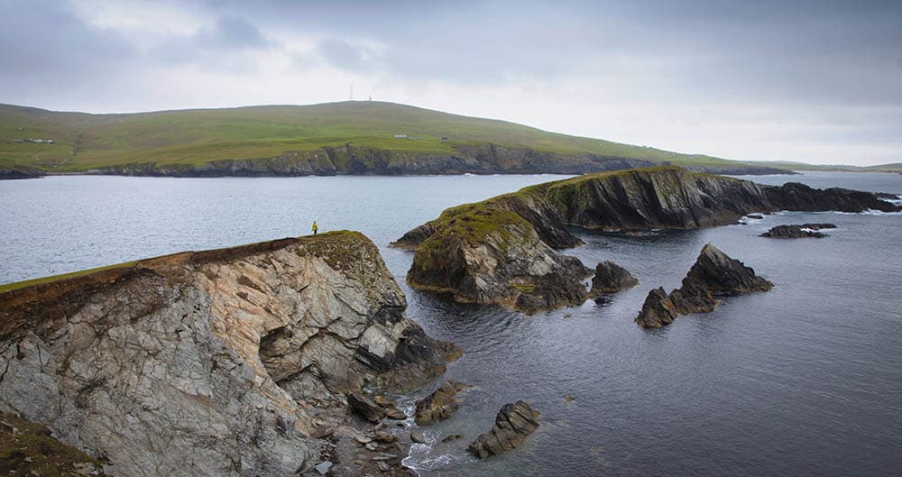
Many people visit just a beach, but we highly recommend taking a walk around the island, which offers spectacular views at each corner. The circular walk around the whole of St.Ninian’s is just under 6km (3.5miles) long and can take around 2.5h to complete. We walked the island clockwise, to follow our footsteps walk to the far end of the tombolo from the car park and then head up the sandy track onto the grassy island (bear to your left).
Soon you will reach the southern tip of the island with views to the rocky islets of Coar Holm and Inns Holmon.
The northern tip – Loose Head is the highest point on St Ninian’s Isle, marked with a trig point.
One more attraction at the end of the walk are remains of St Ninian’s chapel.
The path around the island is grassy with several boggy sections. During the breeding season you can spot many puffins.
3. Papa Stour, Shetland, Scotland
Papa Stour is the eighth largest island in Shetland with small but extremely welcoming community. The ferry terminal area has (we guess out of the good will of the community) been transformed into a small, unofficial campsite and this is where we also set up our tent when visiting the island. You will experience tranquillity and quietness on the island.
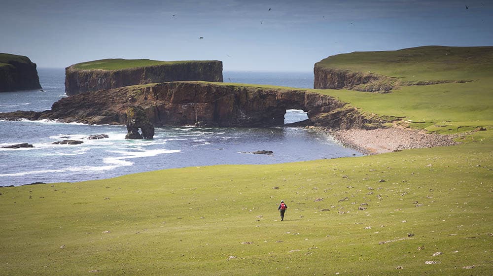
The island’s coastline includes caves, stunning arches, stacks and skerries. And just a bit off the shore you can admire a huge collapsed sea cave – Kirstan’s Hole.
The best way to enjoy what the island has to offer is to take a circular walk around. This is 17km (10.5miles) walk with several cliff climbs and with ‘wow factor’ at every corner. If you do not want to stay on the island overnight ensure to check the ferry timetable. However, we do recommend staying on Papa Stour and enjoying the walk as slowly as possible. There really is a lot to see!
Related: See more about walking in Shetland
4. Old Man of Hoy and St John’s Head, Hoy island, Orkney
The circular walk on the most westernly tip of Isle of Hoy is definitely off beaten track. It can be enjoyed over two days or one long day (but this needs to be coordinated with boats).
The whole route is circa 22km long with over 650m elevation gain in total. Best way to do the hike is to take a boat from Stromness to Moaness (passengers only) and first walk up to Cuilags hill (seen on the right hand side when getting of the boat). Having reached Cuilags top, continue the hike closer to the cliffs, but be prepared for very wet and boggy traverse. It only gets drier closer to St John’s Head cliffs. Those are the highest vertical sea cliffs in the UK at 346m high. This place is very magical with thousands of seabirds flying overhead and making the birdy noises.
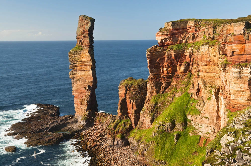
From St. John’s Head continue along the cliff edge until reaching Old Man of Hoy viewpoint – majestic sea stack, a magnet for rock climbers from around the world. The Old Man of Hoy looks especially impressive in its golden glory, if you are lucky to visit when the sun is shining.
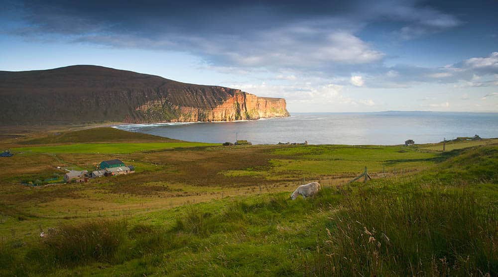
From this point the walk follows a constructed path downhill, to a small settlement of Rackwick, where you can enjoy stunning sand and pebble beach. A small bothy and a hostel are available if you decide to stay overnight. From Rackwick, it’s about 10.5km hike to the boat harbour, to catch the boat back to mainland Orkney.
Coastal walks in Wales
5. Pembrokeshire Coast Path, Wales
The Pembrokeshire Coast Path, a stunning 186-mile long National Trail, winds its way along the rugged and picturesque coastline of Pembrokeshire in Wales. This trail begins in the small town of Amroth in the south and concludes at St. Dogmaels in the north, covering a variety of landscapes, from sandy beaches, and towering cliffs to tiny fishing villages.
186 miles can be completed in 14 days or easily broken down into sections or circular day hikes. On a whole the Pembrokeshire Coastal Path is a moderate hike with some steep and exposed sections.
The first section, from Amroth to Milford Haven, covers 66 miles and passes through the walled seaside town of Tenby, past the monastic Caldey Island and the dramatic cliffs at Stackpole Bay. The coast is dotted with small coves and hidden sea stacks. You need to plan this part of the walk as the path is often closed due military manoeuvres at St Govan’s Head.
The second section, from Milford Haven to St David’s, follows the coast along the vast sweeping beach at Marloes Sands before heading north past Martin’s Haven where the boats to Skomer Island depart in the summer months. Along this coast Broad Haven and Marloes are good places to plan an overnight stay before a night in St David’s, the smallest city in the UK.
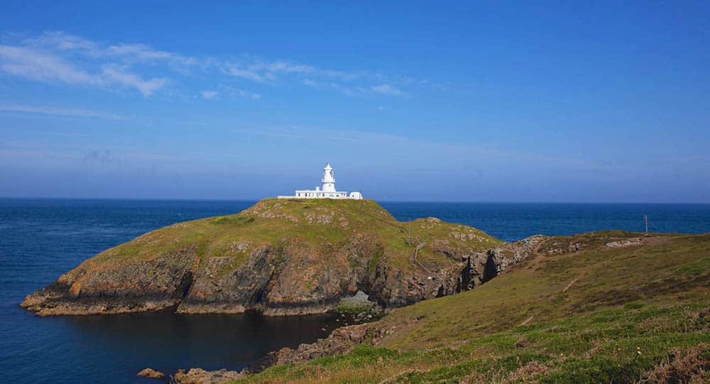
The final section, from St David’s to St Dogmaels, heads north along the rugged and exposed coastline. This part of the coast covers high cliffs and feels much more remote. It takes you past Strumble Head which is good for whale-watching, and the ancient cairns that have been erected on the headlands. There are a few small villages for overnight stay before reaching the Fishguard, only day’s hike away from St Dogmaels where the trail ends.
6. Gower Peninsula Coastal Path,
The hike along the coast at Gower Area of Outstanding Natural Beauty (AONB) is part of 870-mile Welsh Coastal Path and is one of the most loved coastal areas in Wales.
One of the most beautiful sections of the lengthy hike is the path from Mumbles to Crofty, a 66km long walk, covered within 3 – 4 days.
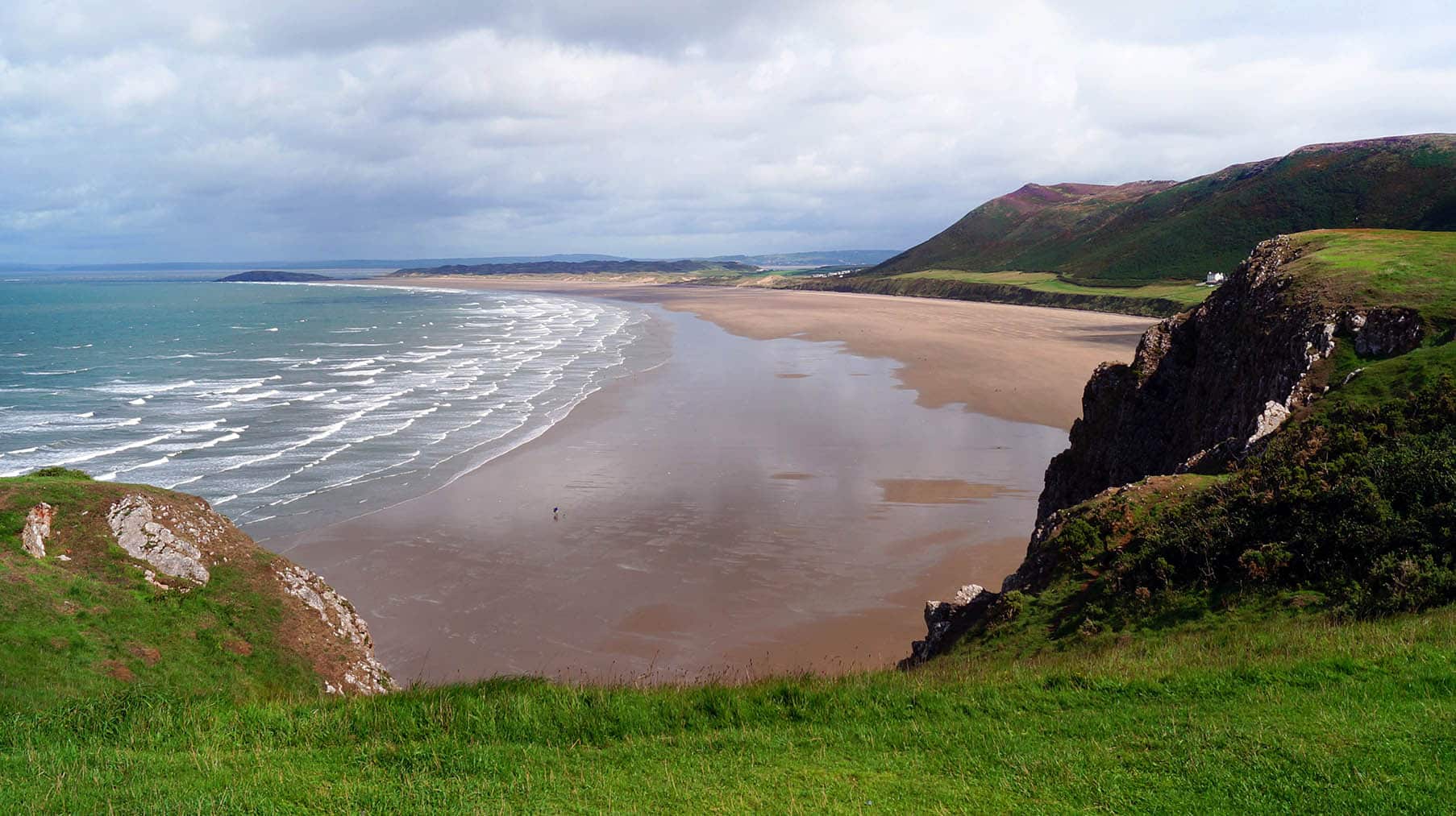
Undoubtedly, some of the highlights of the hike are beautiful beaches, from very secluded ones like Mewslade Bay, to vast stretches of golden sand (Rhossili Bay) and rugged beaches like Bracelet Bay. But it doesn’t end here: craggy headlands, sand dunes, hidden coves, and unique rock formations are awaiting to be discovered if you set your feet on this path.
Multiple Wildlife Trust Reserves, Sites of Special Scientific Interest, National Trust Sites, and Special Areas of Conservation are established along the Gower Peninsula Coastal Path meaning many protected species of flora and fauna can be found along the coast. Seals, dolphins, and porpoises can all be seen in the waters around the coastline.
Llanrhidian Sands and the salt marshes are a paradise for many bird species, with many hideouts scattered in the area for birdwatchers.
Those not keen on wild camping or multi-day hikes are definitely able to explore the coast during day walks either linear or circular ones.
Coastal walks in England
7. Seven Sisters, South Downs National Park, England
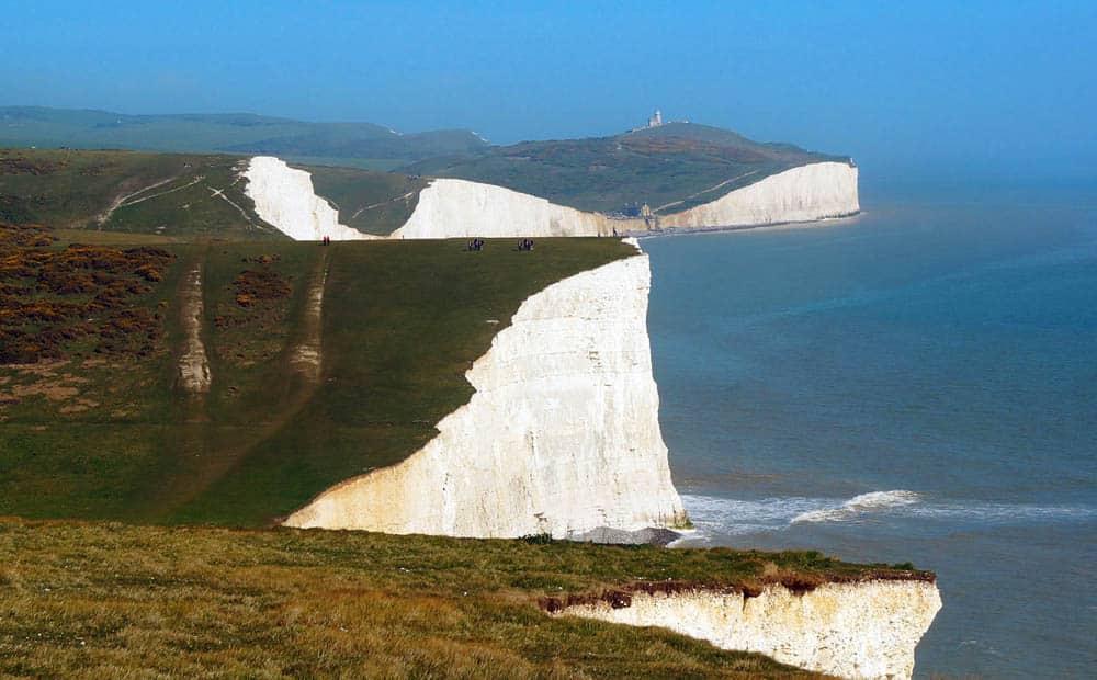
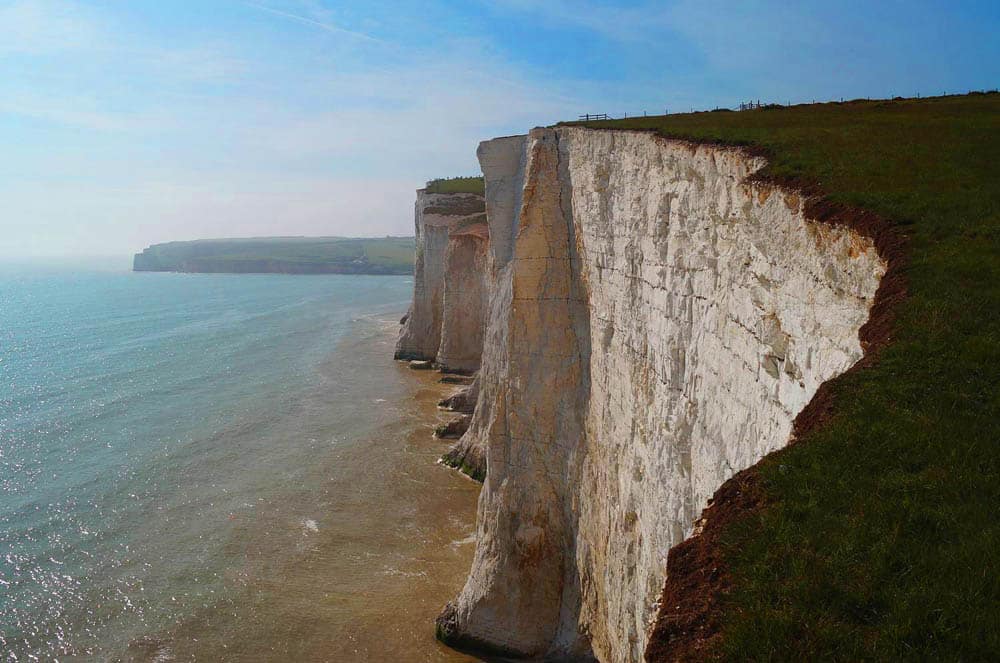
The iconic Seven Sisters are nestled within the beautiful South Downs National Park and a favourite coastal walk in the UK for many.
The greatest thing about the Seven Sisters is that you can choose between a one-day or a multi-day hike across stunning coastal scenery, landscape and spot wildlife along the way.
Seven Sisters are a moderately challenging walk, with elevation gain of just under 100m, but some level of fitness is required to conquer these challenging clifftops.
Start the hike in the lovely seaside town of Eastbourne, with easy public transport links and plenty of things to see and do.
Depending on the distance and the challenge you like, you could even hike as far as Seaford. The distance is about 15-20km, traversing along the seafront at Eastbourne, over the famous Beachy Head, the picture-perfect Belle Tout Lighthouse, before reaching Birling Gap. This is an ideal place to stop for refreshments and rest.
As you continue over the Seven Sisters, you’ll be rewarded with stunning coastal views and landscape, before arriving to Cuckmere River and heading inland, to the crossing at Exceat. On the other side of Cuckmere set your feet on a path returning to the sea coast at Coastguards Cottages. Remember to take time and enjoy the scenery, and while back on the coast, look back for the most epic views of the Seven Sisters!
Many visitors especially mention the beauty of Belle Tout Lighthouse, and the Coastguards Cottages viewpoints.
8. Norfolk Coast Path, England
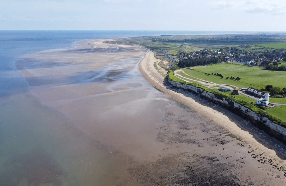
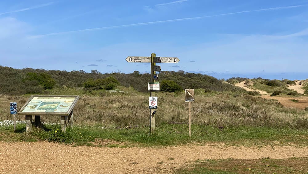
The Norfolk Coast Path is one of the most popular walks in Norfolk, a glorious 84 miles of unspoilt coastline, taking in beaches, traditional holiday towns, salt marshes and nature reserves.
From Hunstanton on Norfolk’s west coast to Hopton-on-Sea, where Norfolk meets Suffolk, this liner route will take around a week to walk depending on your pace and how often you want to stop and enjoy the scenery!
The hike itself is technically easy because Norfolk is renowned for being flat. There is one area of slight elevation as you climb Beeston Bump east of Sheringham, and rise to a whopping 63 metres above sea level! Other areas are undulating as you take in both beaches and cliffs. Some of the route is along sand and shingle which can be hard going when your legs are tired, but there are plenty of places to stop and rest along the way.
The route generally starts in Hunstanton and heads west along the coast. The first section takes you through the Norfolk Area of Outstanding Natural Beauty around Thornham and Brancaster, where birders will love the opportunity to watch migrating birds stopping off on their long journey south.
The route passes along the magnificent beaches of Holkham and Well-next-the-Sea before arriving in Blakeney, known for its colony of Atlantic Seals, the largest in the UK. Continuing east, the Deep History Coast around Happisburgh tells the history of millennia through fossil finds, and you can still find mammoth teeth on the beaches today!
Section from Happisburgh to Hopton includes too many fabulous beaches to mention, but one; Horsey is where the Norfolk Broads meet the sea and Horsey Beach is known for the seals which haul out to give birth on the beach every winter.
There is a good range of accommodation along the route, including pubs, campsites and hotels. The Lifeboat Inn in Thornham, Deepdale Camping in Burnham Deepdale and the Lanterns in Happisburgh are especially worth a mention!
9. The Lizard Peninsula, Cornwall, England
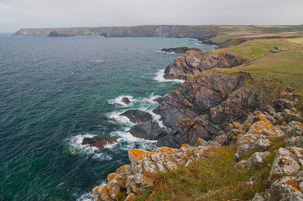
The circular walk on Lizard Peninsula, mainland Britain’s most southerly point is a fantastic hiking opportunity, and a favourite Cornish walk for many. The walk is just over 10km long and it could take around 3h to complete.
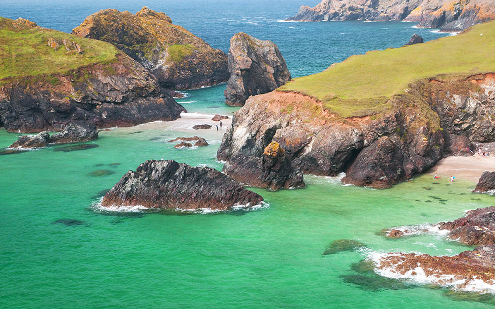
This hike can be started at several points, but Lizard Point or village, or Kynance Cove are the best spots as they offer parking spaces. The Cove is simply breathtaking. Small rugged islands connected by pristine stipes of white sand, and the rock formations scattered along the coast are definitely worth spending time and effort for exploration, possibly finished with a refreshing dip at the end of your walk.
If hiking from Kynance Cove, head east along the coastal path, passing above Pentreath Beach. After around 2km you’ll reach Lizard Point and the Lizard Lighthouse.
Other points of interest along the walk are Lion’s Den (a 12m gap in the cliffs), and the Old Signal Station at Bass Point.
To return to the car park take the path to the left from Bass Point and follow it inland to Lizard village, then take a shortcut back to Kynance Cove.
10. Filey to Bridlington, Yorkshire, England
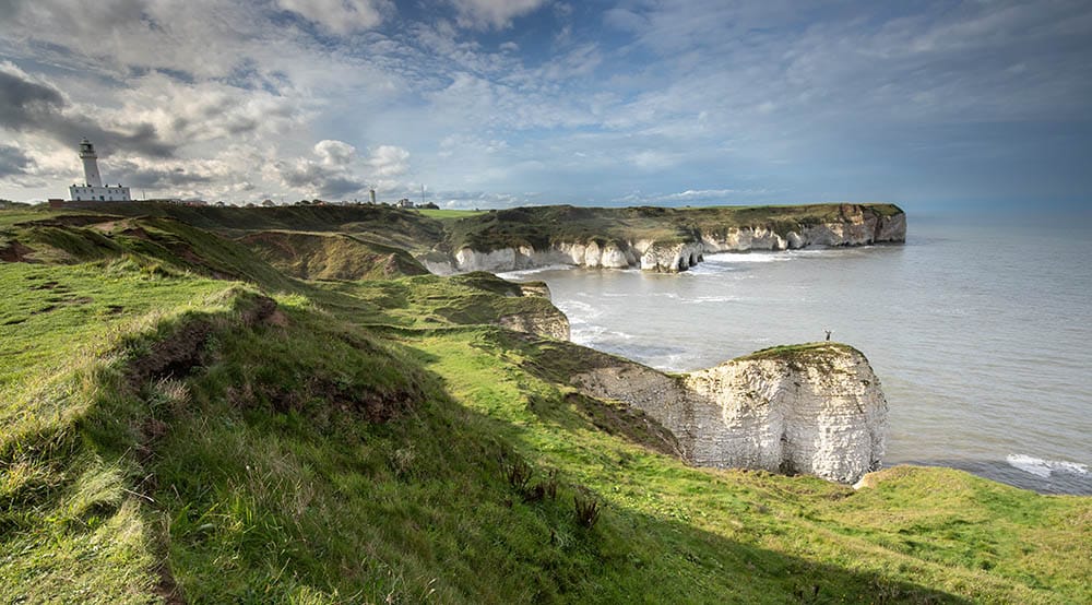
The coastal path between Filey and Bridlington is lesser known than some other English coastal routes but it doesn’t disappoint with stunning views and wildlife experience!
The Filey to Bridlington trail is a section of a 208 mile trail from Bridlington to Bamburgh in Northumberland – the longest stretch of the Coast Path to be opened in England and named ‘King Charles III Coast Path’ in honour of the Coronation.
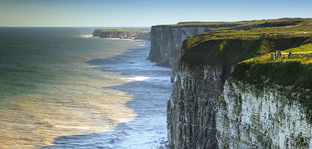
The 34 km long trail spans over the beautiful chalk coast, passes large seabird colony in Bempton, visits North Landing which is a hot spot for seals, and many caves used by the smugglers in 18th century.
All of the 34 km distance can be done within a day, with a return by train (very good railway connections between local coastal towns) so it’s very easy to return to your initial destination.
PRO TIP: ensure to start/finish in Filey at low tide, to be able to enjoy several kilometres walking on a fine, sandy beach.
There are couple of places to have a small bite on the way, like Bempton RSPB café, North Landing café or even at Flamborough Lighthouse or the magnificent Sewerby Hall!
11. Lulworth Cove and Durdle Door, Jurassic Coast, England
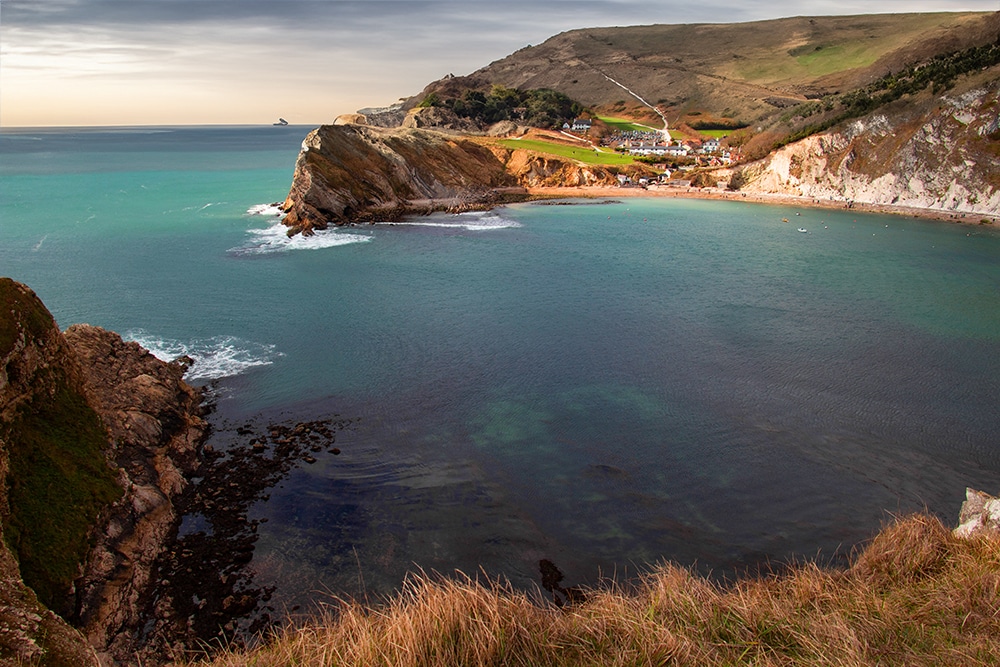
If you’re looking for a stunning, coastal walk with unique formations, then the path from Lulworth Cove to Durdle Door along the Jurassic Coast is a perfect choice.
This hike can be done several ways, but the most popular route is a 3.7-mile out-and-back route that is part of the 630-mile South West Coast Path. This hike can be completed in about 2 hours, and due to the steady inclines, it is considered moderately challenging.
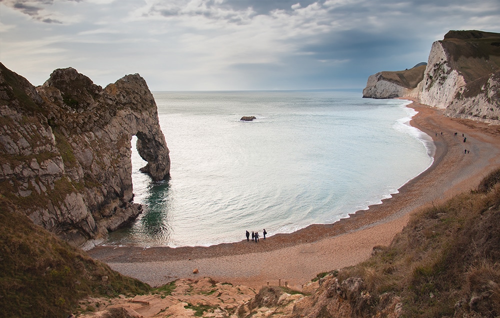
The hike starts at the Lulworth Cove parking lot by the visitor centre and takes you steady uphill to Durdle Door. Durdle Door is a natural limestone arch, created by erosion of softer rocks, it is a part of the Jurassic Coast World Heritage Site. Its unique shape is widely recognized and is well worth viewing from all vantage points.
If you’re feeling up to it, take the steps down to the beach at the base of Durdle Door and admire the formation from sea level. This is also a great place to take a break, have a snack, or picnic.
Retrace your steps back to Lulworth Cove or continue inland to extend the walk.
Whether you are planning to hike an extensive section of the South West Coastal Path or just picking up the best spots along the Jurassic Coast, or looking for a stunning day hike, the Lulworth Cove to Durdle Door route offers gorgeous scenery without being too strenuous.
12. Pilgrim’s Way and Holy Island of Lindisfarne
The Northumberland coastline offers many stunning walks but walking barefoot on the Pilgrim’s Way to the Holy Island of Lindisfarne is a truly unique experience and one that shouldn’t be missed. On this walk you’ll be crossing the sand and mudflats following in the footsteps of early Christian pilgrims.
The Pilgrim’s Way is only around three miles long so is an easy walk that takes around ninety minutes each way. However, since Holy Island is cut off from the mainland by the tides twice daily, walking the Pilgrims Way does take some planning. It’s essential to check the tide times before you set off as the sea comes in quickly and it’s easy to get caught out.
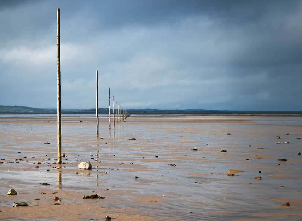
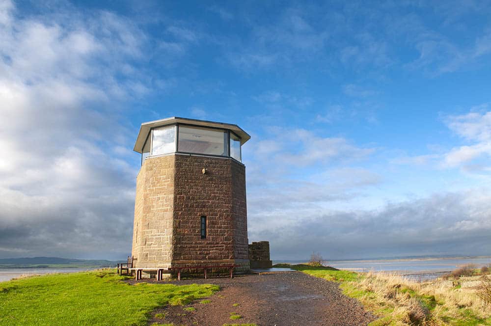
The Pilgrim’s Way starts near the refuge hut at the western end of the causeway where you can access the sand and head to the first marker pole.
Once on the sand you all you need to do is follow the tall marker poles. As the tide changes constantly, so does the terrain. Dry sand gives way to puddles and small rockpools, other areas are slippery with mud (a walking pole will help), and some patches are covered with small seashells which can be painful underfoot.
There’s plenty of birdlife on the Pilgrim’s Way including sandpipers, egrets, and oystercatchers. Depending on the time of year, you might also see groups of seals and hear their ‘song’ carried on the wind.
Once you reach Holy Island (assuming you started walking as soon as the tide made it possible) you’ll have some time to explore before needing to start the return journey. While on the island you could visit historical sites such as Lindisfarne Priory and the Castle, or alternatively extend the coastal walk by following the perimeter of Lindisfarne. Along the extended walk you would visit a lighthouse at the Heugh, The Ouse Bay with unique ‘boat-sheds’, the castle and The Castle Point, and all the way to the wild marshes at the northern end of the island, and the Coves Haven. However, be mindful of tide times and make sure you don’t get cut off or DO get cut off purposefully with accommodation on the islands arranged prior to your visit!
Coastal walks in Northern Ireland
13. Causeway Coast Way, Northern Ireland
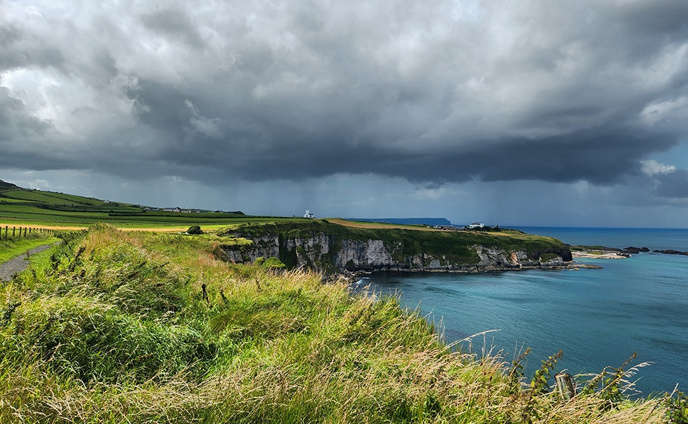
The Causeway Coast Way is a thrilling multi-day walk along Northern Ireland’s emerald coast. This famous 54km trail takes around three days to complete and traverses over some of Northern Irelands most unique land formations, beaches, and quaint seaside towns.
The Causeway Coast Way, which spans between Ballycastle and Portstewart can be walked in either direction but is typically completed from east to west. The hike begins in the small fishing port of Ballycastle and ends on the golden sandy beach of Portstewart Strand, in Portstewart.
During the walk you will be invited to learn about local history, visit ancient remains of Dunluce castle, admire natural landmarks including the famous Giant’s Causeway, eerie mansions, and secluded beaches. Other notable landmarks along the Causeway Coast Way include the Carrick-a-Rede rope bridge, Ballintoy Harbour, and the white sands of White Rock Beach.
This linear hike is best broken up into three days, covering between 15-20km per day, with overnight stays in Dunseverick, Portballintrae and Portstewart. While there are numerous suitable accommodations at each location, vacancies are scarce during prime hiking season.
In high season finding an available place to stay often requires an additional 2-3km walk off the trail and into another town. It’s important to keep this in mind while booking accommodation as your daily kilometers and time of completion will change.
With minimal elevation gain, the Causeway Coast Way is suitable for all fitness levels and ages. This multi-day trek is easy to navigate, very well signposted with markers, and within easy reach to public transport along each section.

14.The Gobbi ns, County Antrim, Northern Ireland
The Gobbins Cliff Path is a thrilling walk located in County Antrim in Northern Ireland, but often overshadowed by its famous brother the Giants Causeway. Unfortunately, many visitors miss this outstanding walking opportunity, but you should not.
It is important to note that this breathtaking walk can be challenging for some, as it involves a lot of climbing, some tight spaces and exposed cliffside drops.
However, designated guides are available for anyone who may find the experience uneasy. The experienced and knowledgeable guides give insight about the hike, and offer a chance to learn about the local history, the trail, as well as local wildlife such as puffins, gannets and dolphins.
The Gobbins trail stretches for a total of 5 km and takes around 2.5 to 3 hours to complete making it the ideal activity for those looking for a half day walk.
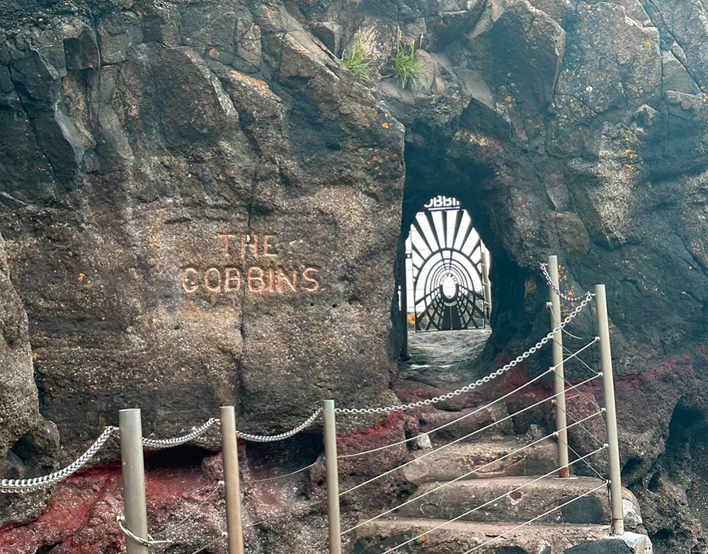
Along the traverse of craggy cliff face, you’ll come across bridges, tunnels, and steps carved into the rock, offering a truly unique and exciting hiking experience. Surprisingly, the trail still remains one of Northern Ireland’s lesser-known attractions despite its unusual styling.
By far one of the most captivating aspects of the Gobbins Cliff Path is its rich wildlife. It is a haven for birdwatchers, with an array of opportunities to spot different types of seabirds such as puffins and gannets (in the breading season). If lucky, you may spot a pod of curious, playful dolphins.
The Gobbins Cliffs Path is an unmissable experience, put it on top of your bucket list for hikes in the UK!